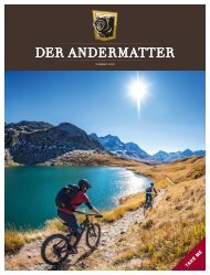

Erfolgreiche ePaper selbst erstellen
Machen Sie aus Ihren PDF Publikationen ein blätterbares Flipbook mit unserer einzigartigen Google optimierten e-Paper Software.
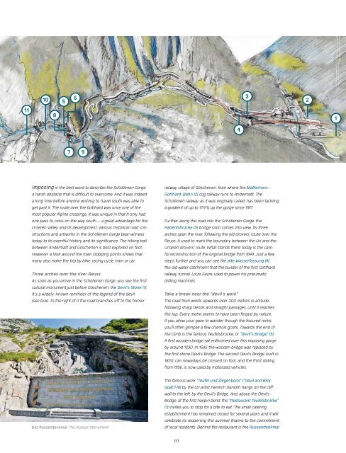
11<br />
10<br />
8<br />
5<br />
6<br />
4<br />
3<br />
2<br />
1<br />
7 9<br />
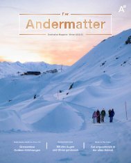
Imposing is the best word to describe the Schöllenen Gorge,<br />
a harsh obstacle that is difficult to overcome. And it was indeed<br />
a long time before anyone wishing to travel south was able to<br />
get past it. The route over the Gotthard was once one of the<br />
most popular Alpine crossings. It was unique in that it only had<br />
one pass to cross on the way south – a great advantage for the<br />
Urseren Valley and its development. Various historical road constructions<br />
and artworks in the Schöllenen Gorge bear witness<br />
today to its eventful history and its significance. The hiking trail<br />
between Andermatt and Göschenen is best explored on foot.<br />
However, a look around the main stopping points shows that<br />
many also make the trip by bike, racing cycle, train or car.<br />
Three arches over the river Reuss<br />
As soon as you arrive in the Schöllenen Gorge, you see the first<br />
cultural monument just before Göschenen: the Devil's Stone (1).<br />
It's a widely-known reminder of the legend of the devil<br />
(see box). To the right of it the road branches off to the former<br />
Das Russendenkmal. The Russian Monument.<br />
railway village of Göschenen, from where the Matterhorn-<br />
Gotthard-Bahn (2) cog railway runs to Andermatt. The<br />
Schöllenen railway, as it was originally called, has been tackling<br />
a gradient of up to 17.9 % up the gorge since 1917.<br />
Further along the road into the Schöllenen Gorge, the<br />
Häderlisbrücke (3) bridge soon comes into view. Its three<br />
arches span the river, following the old drovers' route over the<br />
Reuss. It used to mark the boundary between the Uri and the<br />
Urseren drovers' route. What stands there today is the careful<br />
reconstruction of the original bridge from 1649. Just a few<br />
steps further and you can see the alte Wasserfassung (4),<br />
the old water catchment that the builder of the first Gotthard<br />
railway tunnel, Louis Favre, used to power his pneumatic<br />
drilling machines.<br />
Take a break near the "devil's work"<br />
The road then winds upwards over 300 metres in altitude,<br />
following sharp bends and straight passages, until it reaches<br />
the top. Every metre seems to have been forged by nature.<br />
If you allow your gaze to wander though the fissured rocks,<br />
you'll often glimpse a few chamois goats. Towards the end of<br />
the climb is the famous Teufelsbrücke, or "Devil's Bridge" (5).<br />
A first wooden bridge sat enthroned over this imposing gorge<br />
by around 1230. In 1595 the wooden bridge was replaced by<br />
the first stone Devil's Bridge. The second Devil's Bridge, built in<br />
1830, can nowadays be crossed on foot, and the third, dating<br />
from 1956, is now used by motorized vehicles.<br />
The famous work "Teufel und Ziegenbock" ("Devil and Billy<br />
Goat") (6) by the Uri artist Heinrich Danioth hangs on the cliff<br />
wall to the left, by the Devil's Bridge. And, above the Devil's<br />
Bridge, at the first hairpin bend, the "Restaurant Teufelsbrücke"<br />
(7) invites you to stop for a bite to eat. The small catering<br />
establishment has remained closed for several years and it will<br />
celebrate its reopening this summer thanks to the commitment<br />
of local residents. Behind the restaurant is the Russendenkmal<br />
07