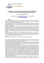
Archaeology and nature: hyblean cultural landscape and territorial ...
Archaeology and nature: hyblean cultural landscape and territorial ...
Archaeology and nature: hyblean cultural landscape and territorial ...

You also want an ePaper? Increase the reach of your titles
YUMPU automatically turns print PDFs into web optimized ePapers that Google loves.
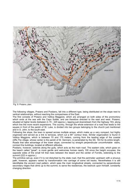
Fig. 9: Praiano, plan.<br />
The following villages, Praiano <strong>and</strong> Positano, fall into a different type, being distributed on the slope next to<br />
vertical relationships, without reaching the compactness of the East.<br />
The first consists of Praiano <strong>and</strong> Vettica Maggiore, which are arranged on both sides of the promontory<br />
which ends at the sea with the Capo Sottile, <strong>and</strong> are therefore directed to the east <strong>and</strong> west. Praiano,<br />
situated at higher levels (between m 70 - 220 approx.), lapping just downstream from the highway 163, along<br />
which line the more recent expansions. The country, through the whole extension of a road that leads to the<br />
square in front of the parish of St. Luke, is divided into two groups belonging to the church just mentioned<br />
<strong>and</strong> in S. John, to the south-east.<br />
Following the slope, the town is spread across multiple arrays, which make up a very compact, but highly<br />
organized <strong>and</strong> served as a link to terraces, which cut a 90° contour lines. Similar organization is found in<br />
Vettica Maggiore, which is between 70 <strong>and</strong> 170 meters, coming from the leading edge of the coastal<br />
cliffs.The village, whose center is the parish of St. Gennaro, is penetrated by the SS. 163 for its entire length.<br />
Roads that take advantage of the lower slope, connected by straight perpendicular uncomfortable stairs,<br />
connect the buildings, located at different altitudes.<br />
Positano, however, extends along the gully, which acts as the main road. The eastern side, which goes on<br />
the beach called "great", is more gentle <strong>and</strong> welcomes homes nearly 100 since the height occupies; the<br />
opposite sides of the small hill that rises between the beach <strong>and</strong> the center of Fornillo, extending to the<br />
summit (222 m approx.).<br />
The primitive set-up, even if it is not disturbed by the state road, that the perimeter upstream with a sinuous<br />
path, however, appears varied by transformation into carriage of some old tracks. Nevertheless it is still<br />
identifiable the ancient road pattern, which sees the main longitudinal streets, connected by perpendicular<br />
secondary ridges that climb up to the summit, to serve the residences, the bedrock upon himself, constantly<br />
changing direction.<br />
1115