- Page 1 and 2:
32EMSE0035 OM91-138 ABBOTSFORD 010
- Page 3 and 4:
Appendix I: LIST OF FIGURES page 28
- Page 5 and 6:
The Hepburn Fault zone is indicated
- Page 7 and 8:
1.0 INTRODUCTION Geophysical ground
- Page 9 and 10:
(30 mi) to the southeast. By road t
- Page 11 and 12:
11 3.2 Property History Canadian Su
- Page 13 and 14:
13 Ontario side ace Cominco Limited
- Page 15 and 16:
15 The La Relne River portion of th
- Page 17 and 18:
17 5.2 Property Mineralization Vary
- Page 19 and 20:
19 6.0 MAGNETOMETER SURVEY The old
- Page 21 and 22:
21 7.0 INDUCED POLARIZATION SURVEY
- Page 23 and 24:
partial intermittent magnetic corre
- Page 25 and 26:
25 (b) Anomaly H-l Zone (IP Anomaly
- Page 27 and 28:
27 O.D.M. (1979) O.D.M. (1972) O.G.
- Page 29:
29 APPENDIX I. LI ST OF FIGURES
- Page 32 and 33:
KING AND KERRICH M Z O M EH l O W C
- Page 34 and 35:
30 APPENDIX II: PROPOSED DIAMOND DR
- Page 36 and 37:
32 APPENDIX III: DETAILED BUDGET PR
- Page 38 and 39:
34 APPENDIX IV: PROJECT EXPENDITURE
- Page 40 and 41:
36 La Reine River Property Expendlt
- Page 42 and 43:
19. Supplies: LaRelne: gas for skl-
- Page 44 and 45:
Project Funding 1 A. Amos L. Blain
- Page 47:
f s (X Is li (0 g e3 f o X S 10 i2
- Page 51 and 52:
NO. 0608 SAMPLE(S)OF: SAMPLE(S) FRO
- Page 53 and 54:
06-JUN-91 REPORT 15605 DPH- REF.FIL
- Page 55 and 56:
XRAL 06-JUN-91 REPORT 15605 REF.FIL
- Page 57 and 58:
XRAL XRF - WHOLE ROCK ANALYSIS 06-J
- Page 59 and 60:
DELL-WHITE ANALYTICAL LABORATORIES
- Page 61 and 62:
NO. 042 '92 82/94 13*39 S 705 672 5
- Page 63 and 64:
'92 02/64 13148 S 785 672 5843 BELL
- Page 65 and 66:
Operating Model C-816/826 Portable
- Page 67 and 68:
32E04SE0035 OM91-138 ABBOTSFORD 020
- Page 69 and 70:
Appendix I: LIST OF FIGURES page 26
- Page 71 and 72:
5 intermediate tuff. The anomaly on
- Page 73 and 74:
L-954648 to L-954652 inclusive L-95
- Page 75 and 76:
3.0 EXPLORATION HISTORY 3.1 Regiona
- Page 77 and 78:
electromagnetic and VLF survey usin
- Page 79 and 80:
13 4.O GEOLOGY 4.1 REGIONAL GEOLOGY
- Page 81 and 82:
15 5.0 MINERALIZATION 5.1 Regional
- Page 83 and 84:
17 6.0 CURRENT WORK CARRIED OUT 6.1
- Page 85 and 86:
19 7.0 RESULTS 7.1 Diamond Drilling
- Page 87 and 88:
21 8.0 CONCLUSIONS AND RECOMMENDATI
- Page 89 and 90:
23 REFERENCES de Carle, R.J. (1988)
- Page 91 and 92:
25 CERTIFICATE OF QUALIFICATION I,
- Page 94 and 95:
Q i 3 1 g S 0 LJ ^t EH o! O di x W
- Page 96 and 97:
KING AND KERJUCII Q W EH en •z. o
- Page 98 and 99:
DIAMOND MILL RECORD NAME OF PROPERT
- Page 100 and 101: DIAMOND DRILL RECORD HOLE NO.PR-91-
- Page 102 and 103: DIAMOND DRILL RECORD HOLE NO.PR-91-
- Page 104 and 105: DIAMOND DRILL RECORD NAME OF PROPER
- Page 106 and 107: —— 2'OOS QQ0Q ..o slli i i; i ,
- Page 108 and 109: QQQQ H; f:: s 5!!: 5 l si 0 I o s**
- Page 110 and 111: \ \ to •st o \ (D ^ \ LU "l \ \ \
- Page 112 and 113: LEGEND QJ—c- SYMBOLS SEAL RIVER E
- Page 114 and 115: BELL-WHITE ANALYTICAL LABORATORIES
- Page 116 and 117: 31 APPENDIX: VI: PROJECT EXPENDITUR
- Page 118 and 119: 33 PATTEN RIVER PROJECT Expenditure
- Page 120 and 121: 35 PATTEN RIVER PROJECT Lesley Blai
- Page 122 and 123: 32E04SE0035 OM91-138 ABBOTSFORD l 0
- Page 124 and 125: -1- I- INTRODUCTION During the mont
- Page 126 and 127: -3- VI- CONCLUSION S RECOMMANDATION
- Page 128: V" f' •*; s:- s 1--, si-.. v "-tt
- Page 131 and 132: O O ro (D C (D L C d) O Q. • r-l
- Page 133 and 134: o O OD O C (O c L O 0. o g \l a D L
- Page 135: Q H J CO 5 0 O J3 "- BJ H < < H w a
- Page 139 and 140: l II 35? 5 t: s
- Page 141 and 142: fi' V) . o lj o O g ~ o S "j j o z
- Page 143 and 144: O^ in K in wi CM* 3 l f. i Vg 2 ' ^
- Page 145 and 146: 32E04SE0035 OM91-138 ABBOTSFORD 040
- Page 147 and 148: SUMMARY The Lightning River Propert
- Page 149: 1.0 INTRODUCTION An Induced Polariz
- Page 153 and 154: induced polarization surveys. Five
- Page 155 and 156: 12 volcanics to the north of the fa
- Page 157 and 158: 14 2) The HcDermott gold deposit Is
- Page 159 and 160: 16 6.0 INDUCED POLARIZATION SURVEY
- Page 161 and 162: 18 8.0 CONCLUSIONS AND RECOMMENDATI
- Page 163 and 164: 20 REFERENCES Belanger, Remy (1991)
- Page 165 and 166: 22 CERTIFICATE OF QUALIFICATION I,
- Page 167 and 168: •S Ij n.t
- Page 169 and 170: ""i!^~ *'- — S'^iT': :' fa - ivrs
- Page 171 and 172: 25 LIGHTNING RIVER PROPERTY PROPOSE
- Page 173 and 174: 27 PHASE II EXPLORATION To consist
- Page 175 and 176: 29 Summary of Expenditures - 1991 L
- Page 177 and 178: 32EMSE0035 OM91-138 ABBOTSFORD 050
- Page 179 and 180: Appendix I: Figure I: Figure 2: Fig
- Page 181 and 182: ppb Au over 3.99 metres In a strong
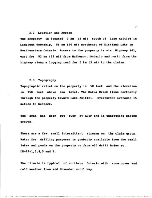
- Page 183 and 184: 7 2.2 Location and Access The prope
- Page 185 and 186: Black River Area was carried out by
- Page 187 and 188: 11 4.O GEOLOGY 4.1 REGIONAL GEOLOGY
- Page 189 and 190: 13 5.0 MINERALIZATION 5.1 Regional
- Page 191 and 192: 15 The alteration zone Is within a
- Page 193 and 194: 17 7.0 DISCUSSION OF RESULTS Interp
- Page 195 and 196: 19 footwall of the North Branch of
- Page 197 and 198: 21 Larder Lake Mining Division, Ont
- Page 199 and 200: 23 APPENDIX I: LIST OF FIGURES
- Page 201 and 202:
CEOPHYSICSICEOCHEMISTRY (35) N-S LI
- Page 203 and 204:
24 APPENDIX II: PROPOSED DIAMOND DR
- Page 205 and 206:
26 APPENDIX III: DETAILED BUDGET PR
- Page 207 and 208:
28 APPENDIX IV: PROJECT EXPENDITURE
- Page 209 and 210:
Lightning River Property 30 Expendi
- Page 211 and 212:
LJ O rO UJ O) ro UJ 00 ro UJ O UJ O
- Page 213 and 214:
LEGEND i P ANOMALIES Definite 2! Pr
- Page 215 and 216:
i y- o CO O o t/) LEGEND MAFIC INTR
- Page 217 and 218:
o PR- firt JL. Q O O O CO LEGEND MA
- Page 219 and 220:
tON S N i Y i ~'..'.-' i \ ^ '" ' \


