Moose River Basin: geology and mineral potential - Geology Ontario
Moose River Basin: geology and mineral potential - Geology Ontario
Moose River Basin: geology and mineral potential - Geology Ontario
Create successful ePaper yourself
Turn your PDF publications into a flip-book with our unique Google optimized e-Paper software.
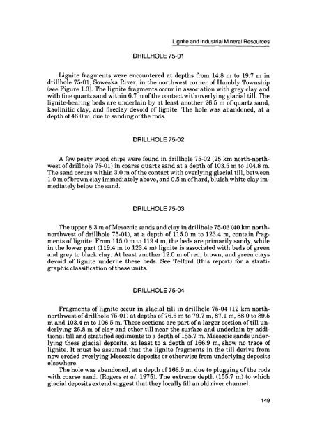
DRILLHOLE 75-01<br />
Lignite <strong>and</strong> Industrial Mineral Resources<br />
Lignite fragments were encountered at depths from 14.8 m to 19.7 m in<br />
drillhole 75-01, Soweska <strong>River</strong>, in the northwest corner of Hambly Township<br />
(see Figure 1.3). The lignite fragments occur in association with grey clay <strong>and</strong><br />
with fine quartz s<strong>and</strong> within 6.7 m of the contact with overlying glacial till. The<br />
lignite-bearing beds are underlain by at least another 26.5 m of quartz s<strong>and</strong>,<br />
kaolinitic clay, <strong>and</strong> fireclay devoid of lignite. The hole was ab<strong>and</strong>oned, at a<br />
depth of 46.0 m, due to s<strong>and</strong>ing of the rods.<br />
DRILLHOLE 75-02<br />
A few peaty wood chips were found in drillhole 75-02 (25 km north-north<br />
west of drillhole 75-01) in coarse quartz s<strong>and</strong> at a depth of 103.5 m to 104.8 m.<br />
The s<strong>and</strong> occurs within 3.0 m of the contact with overlying glacial till, between<br />
1.0 m of brown clay immediately above, <strong>and</strong> 0.5 m of hard, bluish white clay im<br />
mediately below the s<strong>and</strong>.<br />
DRILLHOLE 75-03<br />
The upper 8.3 m of Mesozoic s<strong>and</strong>s <strong>and</strong> clay in drillhole 75-03 (40 km northnorthwest<br />
of drillhole 75-01), at a depth of 115.0 m to 123.4 m, contain frag<br />
ments of lignite. From 115.0 m to 119.4 m, the beds are primarily s<strong>and</strong>y, while<br />
in the lower part (119.4 m to 123.4 m) lignite is associated with beds of green<br />
<strong>and</strong> grey to black clay. At least another 12.0 m of red, brown, <strong>and</strong> green clays<br />
devoid of lignite underlie these beds. See Telford (this report) for a strati<br />
graphic classification of these units.<br />
DRILLHOLE 75-04<br />
Fragments of lignite occur in glacial till in drillhole 75-04 (12 km northnorthwest<br />
of drillhole 75-01) at depths of 76.6 m to 79.7 m, 87.1 m, 88.0 to 89.5<br />
m <strong>and</strong> 103.4 m to 106.5 m. These sections are part of a larger section of till un<br />
derlying 26.8 m of clay <strong>and</strong> other till near the surface <strong>and</strong> underlain by addi<br />
tional till <strong>and</strong> stratified sediments to a depth of 155.7 m. Mesozoic s<strong>and</strong>s under<br />
lying these glacial deposits, at least to a depth of 166.9 m, show no trace of<br />
lignite. It must be assumed that the lignite fragments in the till derive from<br />
now eroded overlying Mesozoic deposits or otherwise from underlying deposits<br />
elsewhere.<br />
The hole was ab<strong>and</strong>oned, at a depth of 166.9 m, due to plugging of the rods<br />
with coarse s<strong>and</strong>. (Rogers et al. 1975). The extreme depth (155.7 m) to which<br />
glacial deposits extend suggest that they locally fill an old river channel.<br />
149


