- Page 1 and 2: THESE TERMS GOVERN YOUR USE OF THIS
- Page 3 and 4: Ontario Geological Survey Study 21
- Page 5: FOREWORD MOOSE RIVER BASIN The Meso
- Page 8 and 9: CONVERSION FACTORS FOR MEASUREMENTS
- Page 10 and 11: In order to maximise the use of sam
- Page 12 and 13: Moose River Basin ABSTRACT The vast
- Page 14 and 15: Moose River Basin the Paleozoic and
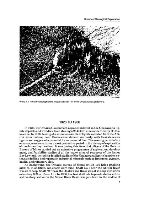
- Page 18 and 19: Moose River Basin the Onakawana are
- Page 20 and 21: Moose River Basin Onakawana were di
- Page 22 and 23: History of Geological Exploration f
- Page 24 and 25: Moose River Basin mounted Acker dri
- Page 26 and 27: Moose River Basin REFERENCES Aquita
- Page 28 and 29: Moose River Basin Henley, T.J., and
- Page 30 and 31: Moose River Basin Shawinigan Engine
- Page 32 and 33: Moose River Basin 2.6-Log of drillh
- Page 34 and 35: Moose River Basin Figure 2.1-Geolog
- Page 36 and 37: Moose River Basin Drillhole Locatio
- Page 38 and 39: Moose River Basin garni and Abitibi
- Page 40 and 41: Moose River Basin quite irregular i
- Page 42 and 43: Moose River Basin OGS10456 Photo 2.
- Page 44 and 45: Moose River Basin OGS10458 Photo 2.
- Page 46 and 47: Moose River Basin DEPTH METRES FEET
- Page 48 and 49: Moose River Basin by Hamblin (this
- Page 50 and 51: Moose River Basin DEPTH METRES FEET
- Page 52 and 53: Moose River Basin DEPTH METRES FEET
- Page 54 and 55: Moose River Basin DEPTH ELEVATION 9
- Page 56 and 57: Moose River Basin sediments of the
- Page 58 and 59: Moose River Basin vicinity of drill
- Page 60 and 61: Moose River Basin Scintex Surveys L
- Page 62 and 63: Moose River Basin 3.4-Hornblende-py
- Page 64 and 65: Moose River Basin TABLE 3.1 SAND SA
- Page 66 and 67:
Moose River Basin The Missinaibi Ri
- Page 68 and 69:
Moose River Basin clay and sand of
- Page 70 and 71:
Moose River Basin DRILLHOLE 75-02 S
- Page 72 and 73:
Moose River Basin PERCENTAGE 57 59
- Page 74 and 75:
Moose River Basin PERCENTAGE 20 30
- Page 76 and 77:
Moose River Basin clays, carbonate,
- Page 78 and 79:
Moose River Basin sin. Samples 185
- Page 80 and 81:
Moose River Basin blue-green hornbl
- Page 82 and 83:
^J- C 3 heavy minerals-amo assembla
- Page 84 and 85:
75-02 75-03 75 -05 75 -06 DEPTH LOG
- Page 86 and 87:
Moose River Basin dium coarse grain
- Page 88 and 89:
Moose River Basin sand with some gr
- Page 90 and 91:
Moose River Basin 101 - well sorted
- Page 92 and 93:
Moose River Basin APPENDIX B All mi
- Page 94 and 95:
Moose River Basin strong pleochrois
- Page 96 and 97:
Moose River Basin HEAVY MINERAL ANA
- Page 98 and 99:
Moose River Basin DRILLHOLE 75-06 d
- Page 100 and 101:
Moose River Basin DRILLHOLE 75-05 D
- Page 102 and 103:
Moose River Basin Telford, P.O., M.
- Page 104 and 105:
Moose River Basin ABSTRACT Disperse
- Page 106 and 107:
Moose River Basin floras from which
- Page 108 and 109:
Moose River Basin Erlansonisporites
- Page 110 and 111:
Moose River Basin Biretisporitespot
- Page 112 and 113:
Moose River Basin Cicatricosisporit
- Page 114 and 115:
Moose River Basin Cicatricosisporit
- Page 116 and 117:
Moose River Basin MOOSE RIVER BASIN
- Page 118 and 119:
Moose River Basin Plate 1. All figu
- Page 120 and 121:
Moose River Basin Plate 2. All figu
- Page 122 and 123:
Moose River Basin Plate 3 All figur
- Page 124:
Moose River Basin Plate 4 All figur
- Page 127 and 128:
23 24 Mesozoic Palynology
- Page 129 and 130:
Mesozoic Palynology 10 fe. 11 12 13
- Page 131 and 132:
24 25 26 Mesozoic Palynology
- Page 133 and 134:
Mesozoic Palynology 10 11 12 13 14
- Page 135 and 136:
Mesozoic Palynology 23 125
- Page 137 and 138:
Mesozoic Palynology
- Page 139 and 140:
Mesozoic Palynology 10 11 13 14 15
- Page 141 and 142:
Mesozoic Palynology REFERENCES Bell
- Page 143:
Mesozoic Palynology Williams, G.L.
- Page 146 and 147:
Moose River Basin Moose River Basin
- Page 148 and 149:
Moose River Basin examined..." and
- Page 150 and 151:
Moose River Basin The Onakawana Lig
- Page 152 and 153:
Moose River Basin o Q. 0) T3 O) 142
- Page 154 and 155:
Moose River Basin In samples of lig
- Page 156 and 157:
Moose River Basin Figure 5.4-Map sh
- Page 158 and 159:
Moose River Basin CHAUSSE CREEK, OP
- Page 160 and 161:
Moose River Basin DRILLHOLE 75-05 T
- Page 162 and 163:
Moose River Basin more is to be gai
- Page 164 and 165:
Lignite and Industrial Mineral Reso
- Page 166 and 167:
Lignite and Industrial Mineral Reso
- Page 168 and 169:
Lignite and Industrial Mineral Reso
- Page 170 and 171:
Lignite and Industrial Mineral Reso
- Page 172 and 173:
Lignite and Industrial Mineral Reso
- Page 174 and 175:
Lignite and Industrial Mineral Reso
- Page 176 and 177:
Lignite and Industrial Mineral Reso
- Page 178 and 179:
Lignite and Industrial Mineral Reso
- Page 180 and 181:
DRILLHOLE 75-03. Lignite and Indust
- Page 182 and 183:
Lignite and Industrial Mineral Reso
- Page 184 and 185:
Lignite and Industrial Mineral Reso
- Page 186 and 187:
Lignite and Industrial Mineral Reso
- Page 188 and 189:
Lignite and Industrial Mineral Reso
- Page 190 and 191:
Lignite and Industrial Mineral Reso
- Page 192 and 193:
Lignite and Industrial Mineral Reso
- Page 194 and 195:
Lignite and Industrial Mineral Reso
- Page 196 and 197:
Lignite and Industrial Mineral Reso
- Page 198 and 199:
INDEX PAGE Abitibi River . . . . .
- Page 200:
PAGE Pleistocene-Mesozoic contact.
- Page 203 and 204:
Moose River Basin REFERENCES Aquita
- Page 205:
21 22 24 25 26 28 30
- Page 209:
11 12 13 14 16 17 18 19 23 25
- Page 215:
10 11 12 13 14 15 ' 4 16 17 18 19 2
- Page 224:
^mm^'^/^'^ tff^ff-^'^^y^ ''xzi^r-*"