
You also want an ePaper? Increase the reach of your titles
YUMPU automatically turns print PDFs into web optimized ePapers that Google loves.
Executive Summary<br />
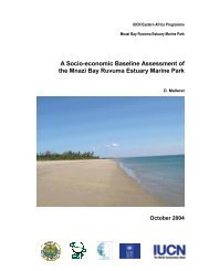
The <strong>Tanga</strong> Coastal Zone Conservation and Development Programme (TCZCDP) started in 1994<br />
with the aim of enhancing the well-being of the coastal communities in the <strong>Tanga</strong> Region by<br />
improving the health of the coastal/marine environment that they depend on.<br />
The Programme is implemented by the three coastal districts of <strong>Tanga</strong> Region (Muheza and<br />
Pangani Districts and <strong>Tanga</strong> Municipality) in collaboration with the Regional Administrative<br />
Secretariat, The Ministry of Natural Resources and Tourism, and the Vice-Presidents Office<br />
(Environment). The Eastern African Regional Office of <strong>IUCN</strong> - The World Conservation Union,<br />
based in Nairobi, provided technical and managerial advice on behalf of the donor agency,<br />
Development Cooperation Ireland. The Programme has been implemented in four phases, Phase 1<br />
(1994-1997), Phase 2 (1997-2000), Phase 3 (2001-2003), and Phase 4 (2004-2006).<br />
One of the major activities of the Programme has been to implement Collaborative Management<br />
Areas (CMAs) through which community-led conservation plans are implemented and by 2001, six<br />
CMAs had been established covering the entire length of the <strong>Tanga</strong> Region coastline. An essential<br />
element in the development and monitoring of resource management plans is the information<br />
provided by fisheries data collected across the three districts. <strong>Fisheries</strong> monitoring has sought to<br />
provide data suitable to assess whether the key objective, improved fishery yields and hence<br />
increased income to CMA residents, has been achieved. This overall objective was to result from<br />
an increase in resource abundance due to Programme activities including reduced destructive<br />
fishing, the creation of closed areas and reduced numbers of ‘visiting’ fishers.<br />
Data have been collected, using three different protocols, on fish-catch, species composition, price,<br />
and the use of marine space by fishers. The 1 st data collection protocol was established in 1995<br />
and continued through to 2000 and mainly collected data from Kigombe Village located in what is<br />
now Mtang’ata CMA. Additional monitoring was conducted at Ushongo and Kipumbwi Villages but<br />
data collection at these two sites was relatively short-lived. The 1 st Protocol adopted by TCZCDP,<br />
using a modified version of the nationwide <strong>Fisheries</strong> Division protocol, collected data on fish catch<br />
(using the local Ki-Swahili taxonomy), fishing effort in terms of vessel and gear-type (although not<br />
including hours spent at sea), the location of fishing (using local names for fishing grounds) and<br />
price data. The 2 nd protocol was introduced in 2000, and after a trial period was extended to 13<br />
villages/landing sites across all six CMAs in existence. This protocol collected similar data but effort<br />
(in hours) was added to the data profile. The new protocol introduced a pre-defined species list and<br />
those species not on the list were recorded under a single category of ‘others’. A third protocol was<br />
introduced in 2003 that sought to improve the statistical validity of the fisheries data by introducing<br />
proper stratification to the sampling regime. Data have been managed in an Access database<br />
developed by TCZCDP. In addition to the fisheries-dependent monitoring, a separate (fisheryindependent)<br />
reef-health monitoring protocol was also established by TCZCDP.<br />
The key fisheries indicator chosen by TCZCDP was catch per unit effort (CPUE) or catch rate.<br />
CPUE is taken as an index of resource abundance: as resources increase so the catch rate would<br />
be expected to increase. The analyses presented in this report are based on a set of data covering<br />
the longest possible time-series, where sample size was sufficient, and comprised data from three<br />
vessel/gear combinations: ngalawa/mishipi (handline); ngalawa/madema (traps); and<br />
ngalawa/jarife (sharknet) from Kigombe Village. Multiple comparisons between mean annual CPUE<br />
for these data were undertaken using the Tukey Test (with the Kramer Modification for unequal<br />
sample sizes). Overall there was no clear increase year-on-year for any of the three datasets<br />
analysed although the datasets did show different apparent patterns in CPUE. CPUE for<br />
ngawala/mishipi has remained fairly constant since the start of monitoring with a significant<br />
increase in 2003/04 data. It remains to be seen whether this is an outlier or whether subsequent<br />
years will continue to show an increase in CPUE, suggesting an increase in the resources targeted<br />
by this vessel/gear combination. Data for ngalawa/madema showed a decline in CPUE of<br />
vii