Preston Township Wayne County - Shepstone Management Company
Preston Township Wayne County - Shepstone Management Company
Preston Township Wayne County - Shepstone Management Company
Create successful ePaper yourself
Turn your PDF publications into a flip-book with our unique Google optimized e-Paper software.
of the Board of Supervisors.<br />
11.6.10 The completion of improvements or a suitable guarantee thereof as set forth in § 14 is a<br />
prerequisite to final plan approval.<br />
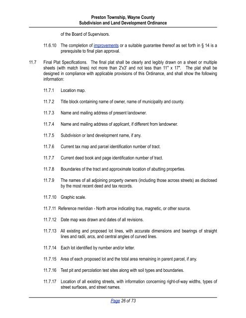
11.7 Final Plat Specifications. The final plat shall be clearly and legibly drawn on a sheet or multiple<br />
sheets (with match lines) not more than 2'x3' and not less than 11" x 17". The plat shall be<br />
designed in compliance with applicable provisions of this Ordinance, and shall show the following<br />
information:<br />
11.7.1 Location map.<br />
11.7.2 Title block containing name of owner, name of municipality and county.<br />
11.7.3 Name and mailing address of present landowner.<br />
11.7.4 Name and mailing address of applicant, if different from landowner.<br />
11.7.5 Subdivision or land development name, if any.<br />
11.7.6 Current tax map and parcel identification number of tract.<br />
11.7.7 Current deed book and page identification number of tract.<br />
11.7.8 Boundaries of the tract and approximate location of abutting properties.<br />
11.7.9 The names of all adjoining property owners (including those across streets) as disclosed<br />
by the most recent deed and tax records.<br />
11.7.10 Graphic scale.<br />
<strong>Preston</strong> <strong>Township</strong>, <strong>Wayne</strong> <strong>County</strong><br />
Subdivision and Land Development Ordinance<br />
11.7.11 Reference meridian - North arrow indicating true, magnetic, or other source.<br />
11.7.12 Date map was drawn and dates of all revisions.<br />
11.7.13 All existing and proposed lot lines, with accurate dimensions and bearings of straight<br />
lines and radii, arcs, and central angles of curved lines.<br />
11.7.14 Each lot identified by number and/or letter.<br />
11.7.15 Area of each proposed lot and the total area remaining in parent parcel, if any.<br />
11.7.16 Test pit and percolation test sites along with soil types and boundaries.<br />
11.7.17 Location of all existing streets, with information concerning right-of-way widths, types of<br />
street surfaces, and street names.<br />
Page 26 of 73


