

E book Field Guide.indd - Gold Country
E book Field Guide.indd - Gold Country
E book Field Guide.indd - Gold Country

You also want an ePaper? Increase the reach of your titles
YUMPU automatically turns print PDFs into web optimized ePapers that Google loves.
The force of tectonic collisions<br />
and the gradual<br />
movements of the earth’s<br />
crust caused Marble<br />
Canyon’s section of the<br />
limestone shelf to buckle<br />
under the intense pressure,<br />
folding and rising<br />
up to its present location<br />
and altitude. Other<br />
plates collided with it,<br />
creating the remainder<br />
of British Columbia as<br />
we know it today. Marble<br />
Canyon’s folding is rather<br />
complex because it<br />
folded, refolded and faulted, creating the main canyon,<br />
a network of side canyons and many interesting rock<br />
formations. The Chimney Rock, also known as Coyote<br />
Rock by the local First Nations people, is just one of<br />
such formations.<br />
The limestone of Marble Canyon matches the limestone<br />
of other isolated pockets in the Cariboo, the southern<br />
Yukon, the Pacific Rim, and various occurrences in<br />
Southeast Asia. Therefore, due to the plate movements<br />
of the continental drift, it seems that sections of the<br />
original limestone shelf traveled an incredible distance!<br />
Fossils of Marble Canyon include crinoids, which are<br />
feathery armed primitive marine invertebrates that<br />
thrived 300 million years ago. Also found are shells of<br />
fusulineds that formed the limestone and other marine<br />
evidence dating back 30 million years.<br />
Two archaeological sites have been located in the<br />
canyon near Hat Creek Valley, where Indian pictographs<br />
can be seen. These ancient sites were occupied by the<br />
Interior Salish people who used the area to collect food.<br />
Marble Canyon is a popular rock climbing destination as<br />
its beauty is relatively untouched. In winter, the waterfall<br />
at the west end of Crown Lake provides superb and<br />
easily accessed ice climbing. It can be accessed by a one<br />
kilometre trail along the lakeshore.<br />
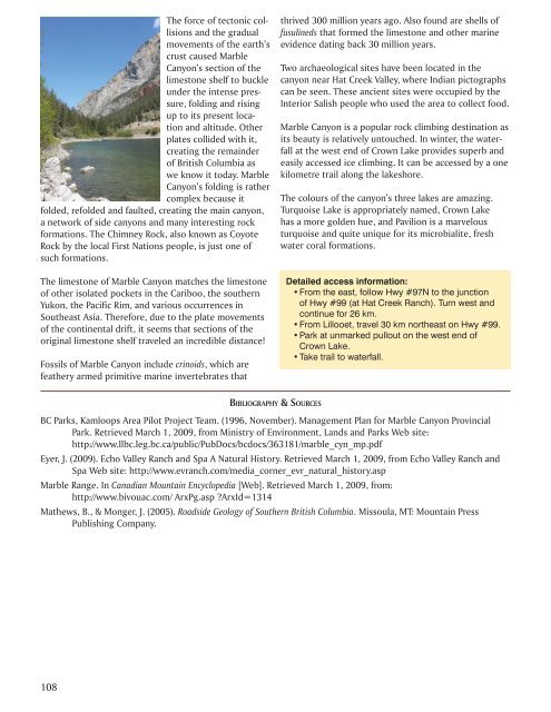
The colours of the canyon’s three lakes are amazing.<br />
Turquoise Lake is appropriately named, Crown Lake<br />
has a more golden hue, and Pavilion is a marvelous<br />
turquoise and quite unique for its microbialite, fresh<br />
water coral formations.<br />
Detailed access information:<br />
• From the east, follow Hwy #97N to the junction<br />
of Hwy #99 (at Hat Creek Ranch). Turn west and<br />
continue for 26 km.<br />
• From Lillooet, travel 30 km northeast on Hwy #99.<br />
• Park at unmarked pullout on the west end of<br />
Crown Lake.<br />
• Take trail to waterfall.<br />
BIBLIOGRAPHY & SOURCES<br />
BC Parks, Kamloops Area Pilot Project Team. (1996, November). Management Plan for Marble Canyon Provincial<br />
Park. Retrieved March 1, 2009, from Ministry of Environment, Lands and Parks Web site:<br />
http://www.llbc.leg.bc.ca/public/PubDocs/bcdocs/363181/marble_cyn_mp.pdf<br />
Eyer, J. (2009). Echo Valley Ranch and Spa A Natural History. Retrieved March 1, 2009, from Echo Valley Ranch and<br />
Spa Web site: http://www.evranch.com/media_corner_evr_natural_history.asp<br />
Marble Range. In Canadian Mountain Encyclopedia [Web]. Retrieved March 1, 2009, from:<br />
http://www.bivouac.com/ ArxPg.asp ?ArxId=1314<br />
Mathews, B., & Monger, J. (2005). Roadside Geology of Southern British Columbia. Missoula, MT: Mountain Press<br />
Publishing Company.<br />
108


