

E book Field Guide.indd - Gold Country
E book Field Guide.indd - Gold Country
E book Field Guide.indd - Gold Country

Create successful ePaper yourself
Turn your PDF publications into a flip-book with our unique Google optimized e-Paper software.
SITE #110301<br />
GC1TTWQ<br />
VIEWS & VISTAS<br />
Promontory Lookout<br />
Written & Researched by Angela Wynton<br />
Nearest Community:<br />
Location:<br />
Geocache Location:<br />
Accuracy:<br />
Letterboxing Clues:<br />
SITE IDENTIFICATION<br />
UTM:<br />
Geocache altitude:<br />
Overall difficulty:<br />
Lower Nicola, V1K 1B8<br />
N 50°11.669’<br />
W 120°58.338’<br />
N 50°11.650’<br />
W 120°58.358’<br />
5 meters<br />
Refer to letterboxing<br />
clues page<br />
East 0644704;<br />
North 5562186 10U<br />
1,715 m./5,625 ft.<br />
1<br />
2<br />
Terrain difficulty:<br />
(1=easiest; 5=hardest)<br />
Date Established: 1862<br />
Ownership: BC Forestry Rec Site<br />
Access: • Gravel Road<br />
• Seasonal<br />
• 4x4 Vehicle<br />
accessible<br />
• Detailed access<br />
information on next<br />
page.<br />
For more information or to report a problem<br />
with this site please contact:<br />
<strong>Gold</strong> <strong>Country</strong> Communities Society<br />
P.O. Box 933 Cache Creek, B.C. V0K 1H0<br />
Tel: 1-877-453-9467<br />
email: info@exploregoldcountry.com<br />
For more site pages go to:<br />
www.goldtrail.com or<br />
www.GeoTourismCanada.com<br />
Apply Sticker<br />
Here<br />
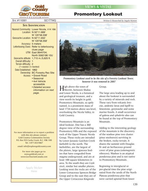
Promontory Lookout used to be the site of a Forestry Lookout Tower,<br />
however it was removed in 2007<br />
High above the town of<br />
Merritt, between Shulus<br />
and Lower Nicola, is a botanical<br />
and geological treasure, and a<br />
view worth its height in gold.<br />
Promontory Mountain, so aptly<br />
named, is a prominent mass of<br />
land 1734 metres above sea level,<br />
overlooking the Nicola Valley, in<br />
<strong>Gold</strong> <strong>Country</strong>.<br />
Promontory Mountain is an<br />
ideal lookout. One has a 360<br />
degree view of the surrounding<br />
Promontory Hills and the exposed<br />
rock of the Upper Triassic Nicola<br />
Group. These rocks are intruded<br />
by Lower Jurassic Guichon Creek<br />
batholith to the north. The<br />
batholithes, are the largest of<br />
the plutons, large igneous bodies<br />
that have congealed from<br />
magma underground, and are at<br />
least 100 square kilometres in<br />
area. To the south they are Coyle<br />
stock, similar but smaller plutons.<br />
Looking west the rocks are of the<br />
Lower Cretaceous Spences Bridge<br />
Group and to the east they are of<br />
the Upper Cretaceous Kingsvale<br />
Group.<br />
The large area leading up to and<br />
about the lookout is surrounded<br />
by a variety of minerals and rock.<br />
These vary from volcanic breccias,<br />
andestic lavas and lapilli to<br />
limestone, greywacke and some<br />
marine fossils. A small occurrence<br />
of galena and sphalerite also can<br />
be found at the top of Promontory<br />
Mountain.<br />
Adding to the interesting geology<br />
of the mountain is the discovery<br />
of the washoe pine tree cluster<br />
(pinus washoensis) surviving in<br />
the broken, rocky terrain. It<br />
shares the summit with Douglas<br />
fir and an herbaceous ground<br />
cover of pine grass (calamagmstis<br />
nibescens). Washoe is an atypical<br />
ponderosa pine and is not native<br />
to Promontory Mountain.<br />
Beginning in interglacial or<br />
pre-glacial time the pine originated<br />
from the seeds of the North<br />
Plateau ponderosa pine that<br />
were carried upwind from lower<br />
139


