

E book Field Guide.indd - Gold Country
E book Field Guide.indd - Gold Country
E book Field Guide.indd - Gold Country

Create successful ePaper yourself
Turn your PDF publications into a flip-book with our unique Google optimized e-Paper software.
Coast Range to the west. Pavilion Mountain and Marble<br />
Canyon can be seen to the northwest, Cariboo <strong>Country</strong><br />
to the north and Kamloops Lake to the northeast. To<br />
the east lies the Ashcroft Ranch in the Thompson River<br />
valley below and above is a limited view of the Highland<br />
Valley Copper Mine.<br />
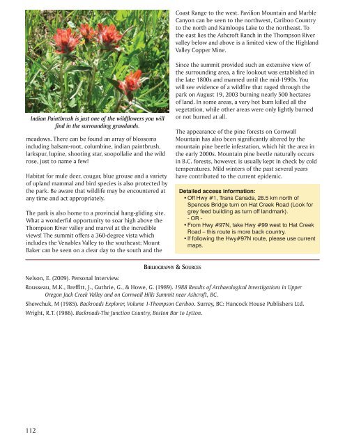
Indian Paintbrush is just one of the wildflowers you will<br />
find in the surrounding grasslands.<br />
meadows. There can be found an array of blossoms<br />
including balsam-root, columbine, indian paintbrush,<br />
larkspur, lupine, shooting star, soopollalie and the wild<br />
rose, just to name a few!<br />
Habitat for mule deer, cougar, blue grouse and a variety<br />
of upland mammal and bird species is also protected by<br />
the park. Be aware that wildlife may be encountered at<br />
any time and act appropriately.<br />
The park is also home to a provincial hang-gliding site.<br />
What a wonderful opportunity to soar high above the<br />
Thompson River valley and marvel at the incredible<br />
views! The summit offers a 360-degree vista which<br />
includes the Venables Valley to the southeast; Mount<br />
Baker can be seen on a clear day to the south and the<br />
Since the summit provided such an extensive view of<br />
the surrounding area, a fire lookout was established in<br />
the late 1800s and manned until the mid-1990s. You<br />
will see evidence of a wildfire that raged through the<br />
park on August 19, 2003 burning nearly 500 hectares<br />
of land. In some areas, a very hot burn killed all the<br />
vegetation, while other areas were only lightly burned<br />
or not burned at all.<br />
The appearance of the pine forests on Cornwall<br />
Mountain has also been significantly altered by the<br />
mountain pine beetle infestation, which hit the area in<br />
the early 2000s. Mountain pine beetle naturally occurs<br />
in B.C. forests, however, is usually kept in check by cold<br />
temperatures. Mild winters of the past several years<br />
have contributed to the current epidemic.<br />
Detailed access information:<br />
• Off Hwy #1, Trans Canada, 28.5 km north of<br />
Spences Bridge turn on Hat Creek Road (Look for<br />
grey feed building as turn off landmark).<br />
- OR -<br />
• From Hwy #97N, take Hwy #99 west to Hat Creek<br />
Road – this route is more back country.<br />
• If following the Hwy#97N route, please use current<br />
maps.<br />
BIBLIOGRAPHY & SOURCES<br />
Nelson, E. (2009). Personal Interview.<br />
Rousseau, M.K., Breffitt, J., Guthrie, G., & Howe, G. (1989). 1988 Results of Archaeological Investigations in Upper<br />
Oregon Jack Creek Valley and on Cornwall Hills Summit near Ashcroft, BC.<br />
Shewchuk, M (1985). Backroads Explorer, Volume 1-Thompson Cariboo. Surrey, BC: Hancock House Publishers Ltd.<br />
Wright, R.T. (1986). Backroads-The Junction <strong>Country</strong>, Boston Bar to Lytton.<br />
112


