

E book Field Guide.indd - Gold Country
E book Field Guide.indd - Gold Country
E book Field Guide.indd - Gold Country

Create successful ePaper yourself
Turn your PDF publications into a flip-book with our unique Google optimized e-Paper software.
SITE #100102<br />
GC1TT1W<br />
PIONEERS & EARLY SETTLERS<br />
The Hudson Bay Company<br />
Brigade Trail<br />
Written & Researched by Doug Smith<br />
Nearest Community:<br />
Location/Parking:<br />
Geocache Location:<br />
Accuracy:<br />
Letterboxing Clues:<br />
SITE IDENTIFICATION<br />
UTM:<br />
Savona, V0K 2J0<br />
N 50°48.362’<br />
W 120°46.686’<br />
N 50°48.388’<br />
W 120°46.674’<br />
6 meters<br />
Refer to letterboxing<br />
clues page<br />
East 0656564;<br />
North 5630656 10U<br />
582 m./1,909 ft.<br />
1.5<br />
3<br />
Geocache altitude:<br />
Overall difficulty:<br />
Terrain difficulty:<br />
(1=easiest; 5=hardest)<br />
c 1843<br />
Crown Land<br />
Date Established:<br />
Ownership:<br />
Access:<br />
• Gravel Road<br />
• Seasonal<br />
• Vehicle accessible<br />
• Detailed access<br />
information on next<br />
page.<br />
For more information or to report a problem<br />
with this site please contact:<br />
<strong>Gold</strong> <strong>Country</strong> Communities Society<br />
P.O. Box 933 Cache Creek, B.C. V0K 1H0<br />
Tel: 1-877-453-9467<br />
email: info@exploregoldcountry.com<br />
For more site pages go to:<br />
www.goldtrail.com or<br />
www.GeoTourismCanada.com<br />
Apply Sticker<br />
Here<br />
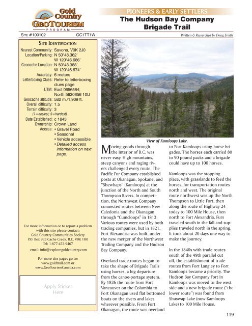
View of Kamloops Lake.<br />
oving goods through<br />
Mthe Interior of B.C. was<br />
never easy. High mountains,<br />
steep canyons and raging rivers<br />
challenged every route. The<br />
Pacific Fur Company established<br />
posts at Okanagan, Spokane, and<br />
“Shewhaps” (Kamloops) at the<br />
junction of the North and South<br />
Thompson Rivers. In competition,<br />
the Northwest Company<br />
connected routes between New<br />
Caledonia and the Okanagan<br />
through “Cumcloops” in 1813.<br />
Various routes were used by both<br />
trading companies, but in 1821,<br />
Fort Alexandria was built, under<br />
the new merger of the Northwest<br />
Trading Company and the Hudson<br />
Bay Company.<br />
Overland trade routes began to<br />
take the shape of Brigade Trails<br />
using horses, a big departure<br />
from the canoe-portage system.<br />
By 1826 the route from Fort<br />
Vancouver on the Columbia to<br />
Fort Okanagan used flat bottomed<br />
boats on the rivers and lakes<br />
wherever possible. From Fort<br />
Okanagan, the route was overland<br />
70 Mile House, c1914<br />
to Fort Kamloops using horse brigades.<br />
The horses each carried 80<br />
to 90 pound packs and a brigade<br />
could have up to 100 horses.<br />
Kamloops was the stopping<br />
place, with grasslands to feed the<br />
horses, for transportation routes<br />
north and west. The original<br />
route northwest was up the North<br />
Thompson to Little Fort, then<br />
along the route of Highway 24<br />
today to 100 Mile House, then<br />
north to Fort Alexandria. Furs<br />
traveled south in the fall and supplies<br />
traveled north in the spring.<br />
It took about 20 days one way to<br />
make the journey.<br />
In the 1840s with trade routes<br />
south of the 49th parallel cut<br />
off, the establishment of trade<br />
routes from Fort Langley to Fort<br />
Kamloops became a priority. The<br />
Hudson Bay Company Fort in<br />
Kamloops was moved to the west<br />
side and a new brigade route (“the<br />
lower route”) was found from<br />
Shuswap Lake (now Kamloops<br />
Lake) to 100 Mile House.<br />
119


