

E book Field Guide.indd - Gold Country
E book Field Guide.indd - Gold Country
E book Field Guide.indd - Gold Country

You also want an ePaper? Increase the reach of your titles
YUMPU automatically turns print PDFs into web optimized ePapers that Google loves.
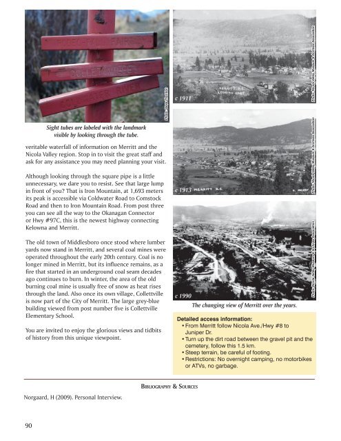
Sight tubes are labeled with the landmark<br />
visible by looking through the tube.<br />
veritable waterfall of information on Merritt and the<br />
Nicola Valley region. Stop in to visit the great staff and<br />
ask for any assistance you may need planning your visit.<br />
Although looking through the square pipe is a little<br />
unnecessary, we dare you to resist. See that large lump<br />
in front of you? That is Iron Mountain, at 1,693 meters<br />
its peak is accessible via Coldwater Road to Comstock<br />
Road and then to Iron Mountain Road. From post three<br />
you can see all the way to the Okanagan Connector<br />
or Hwy #97C, this is the newest highway connecting<br />
Kelowna and Merritt.<br />
The old town of Middlesboro once stood where lumber<br />
yards now stand in Merritt, and several coal mines were<br />
operated throughout the early 20th century. Coal is no<br />
longer mined in Merritt, but its influence remains, as a<br />
fire that started in an underground coal seam decades<br />
ago continues to burn. In winter, the area of the old<br />
burning coal mine is usually free of snow as heat rises<br />
through the land. Also once its own village, Collettville<br />
is now part of the City of Merritt. The large grey-blue<br />
building viewed from post number five is Collettville<br />
Elementary School.<br />
You are invited to enjoy the glorious views and tidbits<br />
of history from this unique viewpoint.<br />
Photo: Steve Thornton<br />
c 1911<br />
c 1913<br />
c 1990<br />
The changing view of Merritt over the years.<br />
Detailed access information:<br />
• From Merritt follow Nicola Ave./Hwy #8 to<br />
Juniper Dr.<br />
• Turn up the dirt road between the gravel pit and the<br />
cemetery, follow this 1.5 km.<br />
• Steep terrain, be careful of footing.<br />
• Restrictions: No overnight camping, no motorbikes<br />
or ATVs, no garbage.<br />
Photo: Nicola Valley Museum & Archives Association<br />
Photo: Nicola Valley Museum & Archives Association<br />
Photo: Nicola Valley Museum & Archives Association<br />
BIBLIOGRAPHY & SOURCES<br />
Norgaard, H (2009). Personal Interview.<br />
90


