

Weeki Wachee River System Recommended Minimum Flows and ...
Weeki Wachee River System Recommended Minimum Flows and ...
Weeki Wachee River System Recommended Minimum Flows and ...

You also want an ePaper? Increase the reach of your titles
YUMPU automatically turns print PDFs into web optimized ePapers that Google loves.
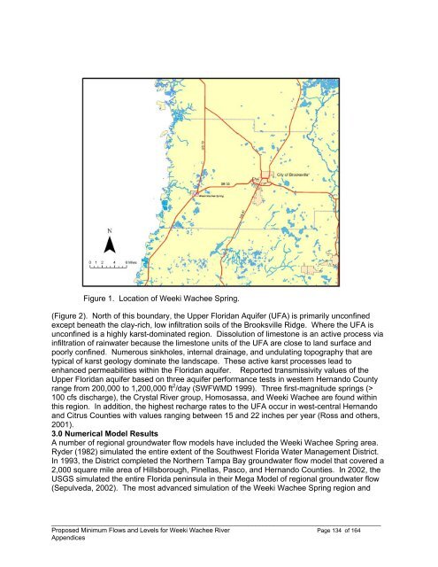
Figure 1. Location of <strong>Weeki</strong> <strong>Wachee</strong> Spring.<br />
(Figure 2). North of this boundary, the Upper Floridan Aquifer (UFA) is primarily unconfined<br />
except beneath the clay-rich, low infiltration soils of the Brooksville Ridge. Where the UFA is<br />
unconfined is a highly karst-dominated region. Dissolution of limestone is an active process via<br />
infiltration of rainwater because the limestone units of the UFA are close to l<strong>and</strong> surface <strong>and</strong><br />
poorly confined. Numerous sinkholes, internal drainage, <strong>and</strong> undulating topography that are<br />
typical of karst geology dominate the l<strong>and</strong>scape. These active karst processes lead to<br />
enhanced permeabilities within the Floridan aquifer. Reported transmissivity values of the<br />
Upper Floridan aquifer based on three aquifer performance tests in western Hern<strong>and</strong>o County<br />
range from 200,000 to 1,200,000 ft 2 /day (SWFWMD 1999). Three first-magnitude springs (><br />
100 cfs discharge), the Crystal <strong>River</strong> group, Homosassa, <strong>and</strong> <strong>Weeki</strong> <strong>Wachee</strong> are found within<br />
this region. In addition, the highest recharge rates to the UFA occur in west-central Hern<strong>and</strong>o<br />
<strong>and</strong> Citrus Counties with values ranging between 15 <strong>and</strong> 22 inches per year (Ross <strong>and</strong> others,<br />
2001).<br />
3.0 Numerical Model Results<br />
A number of regional groundwater flow models have included the <strong>Weeki</strong> <strong>Wachee</strong> Spring area.<br />
Ryder (1982) simulated the entire extent of the Southwest Florida Water Management District.<br />
In 1993, the District completed the Northern Tampa Bay groundwater flow model that covered a<br />
2,000 square mile area of Hillsborough, Pinellas, Pasco, <strong>and</strong> Hern<strong>and</strong>o Counties. In 2002, the<br />
USGS simulated the entire Florida peninsula in their Mega Model of regional groundwater flow<br />
(Sepulveda, 2002). The most advanced simulation of the <strong>Weeki</strong> <strong>Wachee</strong> Spring region <strong>and</strong><br />
____________________________________________________________________________________________<br />
Proposed <strong>Minimum</strong> <strong>Flows</strong> <strong>and</strong> Levels for <strong>Weeki</strong> <strong>Wachee</strong> <strong>River</strong> Page 134 of 164<br />
Appendices


