

Watershed Management Plan - Mason County
Watershed Management Plan - Mason County
Watershed Management Plan - Mason County

Create successful ePaper yourself
Turn your PDF publications into a flip-book with our unique Google optimized e-Paper software.
Appendix<br />
A Sub-basin Summaries<br />
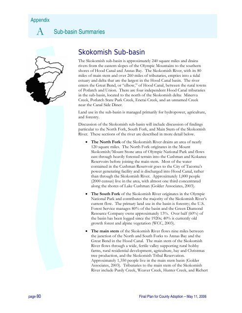
Skokomish Sub-basin<br />
The Skokomish sub-basin is approximately 240 square miles and drains<br />
rivers from the eastern slopes of the Olympic Mountains to the southern<br />
shores of Hood Canal and Annas Bay. The Skokomish River, with its 80<br />
miles of main stem and over 260 miles of tributaries, empties into a tidal<br />
estuary and delta that are the largest in the Hood Canal basin. The river<br />
enters the Great Bend, or “elbow,” of Hood Canal, between the rural towns<br />
of Potlatch and Union. There are four independent Hood Canal tributaries<br />
in the sub-basin, located to the north of the Skokomish delta: Minerva<br />
Creek, Potlatch State Park Creek, Enetai Creek, and an unnamed Creek<br />
near the Canal Side Diner.<br />
Land use in the sub-basin is managed primarily for hydropower, agriculture,<br />
and forestry.<br />
Discussion of the Skokomish sub-basin will include discussion of findings<br />
particular to the North Fork, South Fork, and Main Stem of the Skokomish<br />
River. These sections of the river are described in more detail below.<br />
• The North Fork of the Skokomish River drains an area of nearly<br />
120 square miles. The North Fork originates in the Mount<br />
Skokomish/Mount Stone area of Olympic National Park and flows<br />
east through heavily forested terrain into the Cushman and Kokanee<br />
Reservoirs before joining the main stem. Most of the water<br />
contained in the Cushman Reservoir goes to the City of Tacoma’s<br />
power generating facility and is discharged into Hood Canal, rather<br />
than through the Skokomish River. Approximately 1,000 people<br />
(2000 census) live in the area, with almost one third concentrated<br />
along the shores of Lake Cushman (Golder Associates, 2003).<br />
• The South Fork of the Skokomish River originates in the Olympic<br />
National Park and contributes the majority of the Skokomish River’s<br />
current flow. The primary land use in the basin is forestry; the U.S.<br />
Forest Service manages 80% of the basin and the Green Diamond<br />
Resource Company owns approximately 13%. Over half (60%) of<br />
the basin has been logged since the 1920s; 40% is currently old<br />
growth forest and alpine vegetation (WCC, 2003).<br />
• The main stem of the Skokomish River flows nine miles between<br />
the junction of the North and South Forks to Annas Bay and the<br />
Great Bend in the Hood Canal. The main stem of the Skokomish<br />
River flows through a wide, fertile valley supporting rural hobby<br />
farms, rural residential development, agriculture, hay and Christmas<br />
tree production, and the Skokomish Tribal Reservation.<br />
Approximately 1,350 people live in the main stem basin (Golder<br />
Associates, 2003). Tributaries to the main stem of the Skokomish<br />
River include Purdy Creek, Weaver Creek, Hunter Creek, and Richert<br />
page 80 Final <strong>Plan</strong> for <strong>County</strong> Adoption – May 11, 2006


