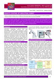
a review - Acta Technica Corviniensis
a review - Acta Technica Corviniensis
a review - Acta Technica Corviniensis

Create successful ePaper yourself
Turn your PDF publications into a flip-book with our unique Google optimized e-Paper software.
ρ is the water density (1000 kg/m 3 ),<br />
g is the acceleration due to gravity (9.81 m/s 2 ), and<br />
H is the gross head (m).<br />
Substituting,<br />
P = 9.81Q H ( kW )<br />
The expression above gives available power, P as a<br />
function of flow rate Q, which is volume of water<br />
passing through a given area in a given time<br />
measured in cubic metres per second; and H, which is<br />
the gross head in metres.<br />
Accordingly, to estimate the hydro-potential capacity<br />
of a site it is important to know the variation of the<br />
discharge throughout the year and the available gross<br />
head.<br />
Determination of available gross head<br />
The gross head is the vertical height that the water<br />
falls through in generating electric power. The field<br />
measurements of gross head are usually carried out<br />
either by using any surveying techniques, namely;<br />
surveyor’s staff and level, Clinometers or Abbey<br />
level, Digital Theodolites with electronic digital level<br />
or surveying by global positioning system<br />
(Tamunotonye, 2005).<br />
Having estimated the gross head available it is<br />
necessary to allow for the losses that may arise from<br />
trash racks, pipe friction, bends and valves. The net<br />
head available to drive turbine is equal to the gross<br />
head minus the sum of all the losses.<br />
Therefore,<br />
H = - ∑<br />
n<br />
H<br />
g<br />
H<br />
l<br />
(2)<br />
where, H n is the net head,<br />
H g is the gross head, and<br />
ΣH l is summation of all the head losses.<br />
ESTIMATION OF STREAM FLOW. Data collection<br />
The hydrological data required in SHP development<br />
are mainly stream flow and rainfall data. Stream<br />
flow fluctuates, and this fluctuation can be<br />
visualized when the flows are plotted against the<br />
time. Understanding the pattern reveals when to<br />
measure low flow and average flow.<br />
Measurements of stream flow from a hydrological<br />
stream-gauging network are the main and best source<br />
of the surface water flow data (Ram S. Gupta, 1989).<br />
However, no national data collection program<br />
anywhere in the world collects sufficient data to<br />
satisfy all the design and decision-making needs in<br />
any catchment area (Fleming, 1976). The world<br />
meteorological organization recommended that when<br />
the data are inadequate; project activity should<br />
begin with installation of a hydrological gauging<br />
network.<br />
In Nigeria, stream flow measurements are carried out<br />
by government through the River Basin Development<br />
Authority, who established gauging stations on rivers<br />
within their catchment area and these flow data can<br />
be obtained from them. However, in the past fifteen<br />
years there have not been stream flow measurements<br />
due to lack of funding. Therefore, flow data<br />
collections for most of the rivers have since stopped,<br />
resulting inadequate data for analysis (Nwachukwu,<br />
2005).<br />
In practice, streams of interest usually are not<br />
gauged and there are no flow records to work with,<br />
118<br />
ACTA TECHNICA CORVINIENSIS – Bulletin of Engineering<br />
so gauging stations have to be established to obtain<br />
discharge for at least a year.<br />
Measurement of stream flow<br />
The volume of water passing through a given area in<br />
a given time measured in cubic metres per second is<br />
described as flow rate. Thus, the product of the<br />
cross-sectional area of the stream and the velocity be<br />
measured is the flow rate (Tamunotonye, 2005),<br />
Qmean = Vmean<br />
× A<br />
(3)<br />
where, Q mean is the mean flow rate (m 3 /s),<br />
V mean is the mean velocity (m/s), and<br />
A is the cross-section area of the stream (m 2 ).<br />
The cross-sectional area of a water course can be<br />
obtained by dividing the cross section into a series of<br />
trapezoids. Measuring the trapezoid sides, by marked<br />
rules the cross-section area would be given by,<br />
( h h h ............... h )<br />
1<br />
+<br />
2<br />
+<br />
3<br />
+ . +<br />
n<br />
A = b ×<br />
(4)<br />
n<br />
where, h 1 , h 2 , ………. = water depth at different<br />
points along the base level<br />
b = width across the river<br />
Figure 1. Cross-section of a river<br />
The velocity across the flow and vertical is not<br />
constant; so, in order to obtain a mean value it is<br />
necessary to measure velocity of water at a number<br />
of points.<br />
There are several methods applicable in measuring<br />
the stream flow, a few common and less expensive<br />
methods are stated: bucket, float, current meter and<br />
stage control methods<br />
STREAM FLOW DATA REQUIREMENT<br />
In designing a small hydropower scheme mean<br />
monthly and annual flow record are often used. The<br />
stream flow and rainfall data for the catchment area<br />
of the stream under investigation are required. The<br />
available record must be of adequate length in order<br />
for analysis to be meaningful. Generally, small<br />
hydropower schemes have a life span of range of 20-<br />
50 years depending on the make, type and capacity<br />
(Nigam, 1985). Therefore, 20 years stream flow<br />
record is considered adequate for the analysis and<br />
development of small hydropower schemes.<br />
The desirable length of stream flow record will<br />
largely depend on the length of available, rainfall<br />
and availability of stream flow records of other<br />
rivers within the project area. Success of the scheme<br />
depends on how accurate has been the estimation of<br />
total quality of water available and its variability.<br />
Proper estimation of water availability is, therefore,<br />
very essential. This would require collection of data<br />
and then computation by suitable method on the<br />
basis of available data.<br />
For computation of water availability, rain fall and<br />
run-off data should be collected. The water<br />
availability for SHP is based on 90% dependability<br />
2013. Fascicule 2 [April–June]