Where am I? Sensors and Methods for Mobile Robot Positioning
Where am I? Sensors and Methods for Mobile Robot Positioning
Where am I? Sensors and Methods for Mobile Robot Positioning
You also want an ePaper? Increase the reach of your titles
YUMPU automatically turns print PDFs into web optimized ePapers that Google loves.
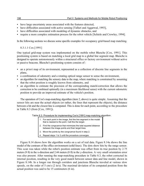
198 Part II Systems <strong>and</strong> <strong>Methods</strong> <strong>for</strong> <strong>Mobile</strong> <strong>Robot</strong> <strong>Positioning</strong><br />
C have large uncertainty areas associated with the features detected,<br />
C have difficulties associated with active sensing [Talluri <strong>and</strong> Aggarwal, 1993],<br />
C have difficulties associated with modeling of dyn<strong>am</strong>ic obstacles, <strong>and</strong><br />
C require a more complex estimation process <strong>for</strong> the robot vehicle [Schiele <strong>and</strong> Crowley, 1994].<br />
In the following sections we discuss some specific ex<strong>am</strong>ples <strong>for</strong> occupancy grid-based map matching.<br />
8.3.1.1 Cox [1991]<br />
One typical grid-map system was implemented on the mobile robot Blanche [Cox, 1991]. This<br />
positioning system is based on matching a local grid map to a global line segment map. Blanche is<br />
designed to operate autonomously within a structured office or factory environment without active<br />
or passive beacons. Blanche's positioning system consists of :<br />
C<br />
C<br />
C<br />
C<br />
an a priori map of its environment, represented as a collection of discrete line segments in the<br />
plane,<br />
a combination of odometry <strong>and</strong> a rotating optical range sensor to sense the environment,<br />
an algorithm <strong>for</strong> matching the sensory data to the map, where matching is constrained by assuming<br />
that the robot position is roughly known from odometry, <strong>and</strong><br />
an algorithm to estimate the precision of the corresponding match/correction that allows the<br />
correction to be combined optimally (in a maximum likelihood sense) with the current odometric<br />
position to provide an improved estimate of the vehicle's position.<br />
The operation of Cox's map-matching algorithm (item 2, above) is quite simple. Assuming that the<br />
sensor hits are near the actual objects (or rather, the lines that represent the objects), the distance<br />
between a hit <strong>and</strong> the closest line is computed. This is done <strong>for</strong> each point, according to the procedure<br />
in Table 8.3 (from [Cox, 1991]).<br />
Table 8.3: Procedure <strong>for</strong> implementing Cox's [1991] map-matching algorithm .<br />
1. For each point in the image, find the line segment in the model<br />
that is nearest to the point. Call this the target.<br />
2. Find the congruence that minimizes the total squared distance<br />
between the image points <strong>and</strong> their target lines.<br />
3. Move the points by the congruence found in step 2.<br />
4. Repeat steps 1 to 3 until the procedure converges.<br />
Figure 8.14 shows how the algorithm works on a set of real data. Figure 8.14a shows the line<br />
model of the contours of the office environment (solid lines). The dots show hits by the range sensor.<br />
This scan was taken while the robot's position estimate was offset from its true position by 2.75<br />
meters (9 ft) in the x-direction <strong>and</strong> 2.44 meters (8 ft) in the y-direction. A very small orientation error<br />
was also present. After running the map-matching procedure in Table 8.3, the robot corrected its<br />
internal position, resulting in the very good match between sensor data <strong>and</strong> line model, shown in<br />
Figure 8.14b. In a longer run through corridors <strong>and</strong> junctions Blanche traveled at various slow<br />
speeds, on the order of 5 cm/s (2 in/s). The maximal deviation of its computed position from the<br />
actual position was said to be 15 centimeters (6 in).


