

Vegetation Classification and Mapping Project Report - the USGS
Vegetation Classification and Mapping Project Report - the USGS
Vegetation Classification and Mapping Project Report - the USGS

You also want an ePaper? Increase the reach of your titles
YUMPU automatically turns print PDFs into web optimized ePapers that Google loves.
patterns can be assessed in relation to <strong>the</strong> terrain. Recognizing <strong>the</strong> need to augment manual<br />
procedures with automated techniques, <strong>the</strong> steps described below integrate conventional<br />
photointerpretation procedures with digital processing technology in an attempt to streamline <strong>the</strong><br />
database <strong>and</strong> map compilation process.<br />
At <strong>the</strong> beginning of <strong>the</strong> GRSM mapping project, <strong>the</strong> photointerpreters, in conjunction with<br />
NPS plant specialists, conducted field investigations to collect data on <strong>the</strong> forest communities<br />
<strong>and</strong> correlate signatures evident on <strong>the</strong> aerial photographs with ground observations.<br />
Consequently, UTM coordinates <strong>and</strong> field data were collected at over 2000 locations with <strong>the</strong> aid<br />
of a Garmin III Plus h<strong>and</strong>-held GPS receiver <strong>and</strong> a Kodak Digital Field Imaging System (FIS)<br />
265 digital camera system. The h<strong>and</strong>-held Kodak digital camera was connected to <strong>the</strong> Garmin<br />
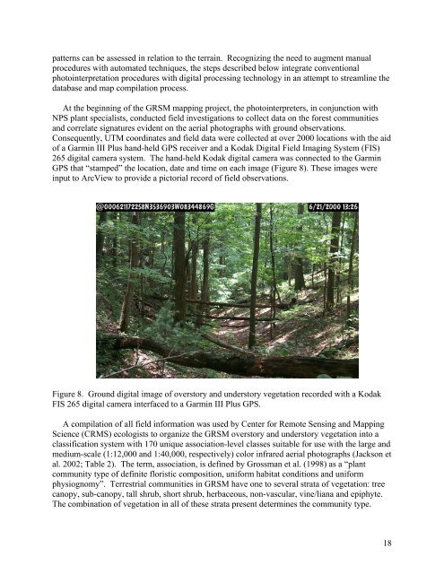
GPS that “stamped” <strong>the</strong> location, date <strong>and</strong> time on each image (Figure 8). These images were<br />
input to ArcView to provide a pictorial record of field observations.<br />
Figure 8. Ground digital image of overstory <strong>and</strong> understory vegetation recorded with a Kodak<br />
FIS 265 digital camera interfaced to a Garmin III Plus GPS.<br />
A compilation of all field information was used by Center for Remote Sensing <strong>and</strong> <strong>Mapping</strong><br />
Science (CRMS) ecologists to organize <strong>the</strong> GRSM overstory <strong>and</strong> understory vegetation into a<br />
classification system with 170 unique association-level classes suitable for use with <strong>the</strong> large <strong>and</strong><br />
medium-scale (1:12,000 <strong>and</strong> 1:40,000, respectively) color infrared aerial photographs (Jackson et<br />
al. 2002; Table 2). The term, association, is defined by Grossman et al. (1998) as a “plant<br />
community type of definite floristic composition, uniform habitat conditions <strong>and</strong> uniform<br />
physiognomy”. Terrestrial communities in GRSM have one to several strata of vegetation: tree<br />
canopy, sub-canopy, tall shrub, short shrub, herbaceous, non-vascular, vine/liana <strong>and</strong> epiphyte.<br />
The combination of vegetation in all of <strong>the</strong>se strata present determines <strong>the</strong> community type.<br />
18


