Public Open Space Guidelines 2.17 Mb - Devonport City Council
Public Open Space Guidelines 2.17 Mb - Devonport City Council
Public Open Space Guidelines 2.17 Mb - Devonport City Council
You also want an ePaper? Increase the reach of your titles
YUMPU automatically turns print PDFs into web optimized ePapers that Google loves.
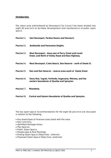
Introduction.The urban area administered by <strong>Devonport</strong> <strong>City</strong> <strong>Council</strong> has been divided intoeight (8) precincts to facilitate development and maintenance of public openspace.Precinct 1.East <strong>Devonport</strong>, Pardoe Downs and Rannoch.Precinct 2.Ambleside and Panorama Heights.Precinct 3.West <strong>Devonport</strong> - Area east of Percy Street and LovettStreet, and North of Valley Road and Bass Highway.Precinct 4.West <strong>Devonport</strong>, Coles Beach, Don Reserve - north of Steele St.Precinct 5.Don and Don Reserve – reserve area south of Steele Street.Precinct 6.Stony Rise, Tugrah, Forthside, Eugenana, Melrose, and thewestern boundaries of Quoiba and Spreyton.Precinct 7.Miandetta.Precinct 8.Central and Eastern Boundaries of Quoiba and Spreyton.The key open space recommendations for the eight (8) precincts are discussedin relation to the following:• Key Assets/Special Features associated with the area;• Key Concerns;• Identified Heritage Areas;• Play <strong>Space</strong>s;• <strong>Public</strong> <strong>Open</strong> <strong>Space</strong>;• Streetscape & Park Plantings;• Existing <strong>Open</strong> <strong>Space</strong> Objectives; (internal)• Proposed <strong>Open</strong> <strong>Space</strong> Objectives. (external)PART D: PRECINCT CHARACTER PROFILES & OBJECTIVES 3


