Developement Of An Instrument Landing Simulation ... - Cal Poly
Developement Of An Instrument Landing Simulation ... - Cal Poly
Developement Of An Instrument Landing Simulation ... - Cal Poly

Create successful ePaper yourself
Turn your PDF publications into a flip-book with our unique Google optimized e-Paper software.
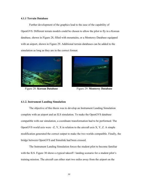
4.1.1 Terrain DatabaseFurther development of the graphics lead to the ease of the capability ofOpenGVS. Different terrain models could be chosen to allow the pilot to fly in a Koreandatabase, shown in Figure 28, filled with mountains, or a Monterey Database equippedwith an airport, shown in Figure 29. Additional terrain databases can be added to thesimulation as long as they are in the correct format.Figure 28: Korean DatabaseFigure 29: Monterey Database4.1.2. <strong>Instrument</strong> <strong>Landing</strong> <strong>Simulation</strong>The objective of this thesis was to develop an <strong>Instrument</strong> <strong>Landing</strong> <strong>Simulation</strong>complete with an airport and an ILS simulation. To make the OpenGVS databasecompatible with our simulation, a coordinate transformation had to be performed. TheOpenGVS world axis were –Z, Y, X in relation to the aircraft axis X, Y, Z. A simplemodification generated the correct output to make the two worlds compatible. Finally, thebridge between OpenGVS and Simulink had been crossed.The <strong>Instrument</strong> <strong>Landing</strong> <strong>Simulation</strong> forces the student pilot to become familiarwith the ILS. Figure 30 shows a typical takeoff / landing scenario for a student pilot’straining mission. The aircraft can either start two miles away from the airport on the30