Appendix - Peak District National Park Authority
Appendix - Peak District National Park Authority
Appendix - Peak District National Park Authority

You also want an ePaper? Increase the reach of your titles
YUMPU automatically turns print PDFs into web optimized ePapers that Google loves.
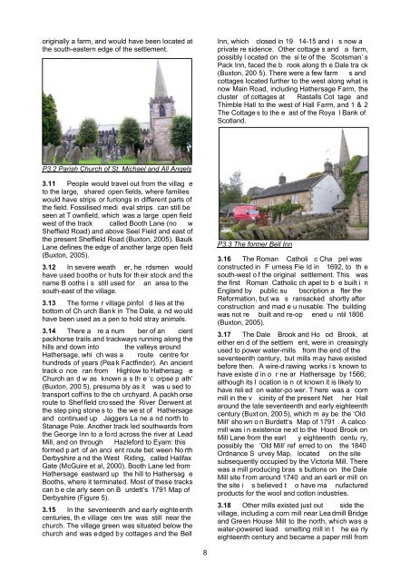
originally a farm, and would have been located atthe south-eastern edge of the settlement.Inn, which closed in 19 14-15 and i s now aprivate re sidence. Other cottage s and a farm,possibly l ocated on the si te of the Scotsman’ sPack Inn, faced the b rook along th e Dale tra ck(Buxton, 200 5). There were a few farm s andcottages located further to the west along what isnow Main Road, including Hathersage Farm, thecluster of cottages at Rastalls Cot tage andThimble Hall to the west of Hall Farm, and 1 & 2The Cottage s to the e ast of the Roya l Bank ofScotland.P3.2 Parish Church of St. Michael and All Angels3.11 People would travel out from the villag eto the large, shared open fields, where familieswould have strips or furlongs in different parts ofthe field. Fossilised medi eval strips can still beseen at T ownfield, which was a large open fieldwest of the track called Booth Lane (no wSheffield Road) and above Seel Field and east ofthe present Sheffield Road (Buxton, 2005). BaulkLane defines the edge of another large open field(Buxton, 2005).3.12 In severe weath er, he rdsmen wouldhave used booths or huts for th eir stock and thename B ooths i s still used for an area to thesouth-east of the village.3.13 The forme r village pinfol d lies at thebottom of Ch urch Ban k in The Dale, a nd wo uldhave been used as a pen to hold stray animals.3.14 There a re a num ber of an cientpackhorse trails and trackways running along thehills and down into the valleys aroundHathersage, whi ch was a route centre forhundreds of years (Pea k Factfinder). An ancienttrack o nce ran from Highlow to Hathersag eChurch an d w as known a s th e ‘c orpse p ath’(Buxton, 200 5), presuma bly as it was u sed totransport coffins to the ch urchyard. A packh orseroute to Shef field cro ssed the River Derwent atthe step ping stone s to the we st of Hathersageand continued up Jaggers La ne a nd north toStanage Pole. Another track led southwards fromthe George Inn to a ford across the river at LeadMill, and on through Hazleford to Eyam: thisformed p art of an anci ent route bet ween No rthDerbyshire a nd the West Riding, called HalifaxGate (McGuire et al, 2000). Booth Lane led fromHathersage eastward up the hill to Hathersag eBooths, where it terminated. Most of these trackscan b e cle arly seen on B urdett’s 1791 Map ofDerbyshire (Figure 5).3.15 In the seventeenth and ea rly eighte enthcenturies, th e village cen tre was still near thechurch. The village green was situated below thechurch and was edged by cottages and the BellP3.3 The former Bell Inn3.16 The Roman Catholi c Cha pel wasconstructed in F urness Fie ld in 1692, to th esouth-west o f the original settlement. This wasthe first Roman Catholic ch apel to b e built i nEngland by public su bscription a fter theReformation, but wa s ransacked shortly afterconstruction and mad e u nusable. The buildingwas not re built and re-op ened u ntil 1806(Buxton, 2005).3.17 The Dale Brook and Ho od Brook, ateither en d of the settlem ent, were in creasinglyused to power water-mills from the end of theseventeenth century, but mills may have existedbefore then. A wire-d rawing works i s known tohave existe d in o r ne ar Hathersage by 1566;although its l ocation is n ot known it is likely tohave reli ed on water-po wer. T here was a cornmill in the v icinity of the present Net her Hallaround the late seventeenth and early eighteenthcentury (Buxt on, 200 5), which m ay be the ‘OldMill’ sho wn o n Burdett’s Map of 1791 . A calicomill was i n existence ne xt to the Hood Brook onMill Lane from the earl y eighteenth centu ry,possibly the ‘Old Mill’ ref erred to on the 1840Ordnance S urvey Map, located on the sitesubsequently occupied by the Victoria Mill. Therewas a mill producing bras s buttons on the DaleMill site f rom around 1740 and an earli er mill onthe site i s believed t o have ma nufacturedproducts for the wool and cotton industries.3.18 Other mills existed just out side thevillage, including a corn mill near Lea dmill Bridgeand Green House Mill to the north, which was awater-powered lead smelting mill in t he ea rlyeighteenth century and became a paper mill from8