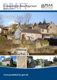
Appendix - Peak District National Park Authority
Appendix - Peak District National Park Authority
Appendix - Peak District National Park Authority

Create successful ePaper yourself
Turn your PDF publications into a flip-book with our unique Google optimized e-Paper software.
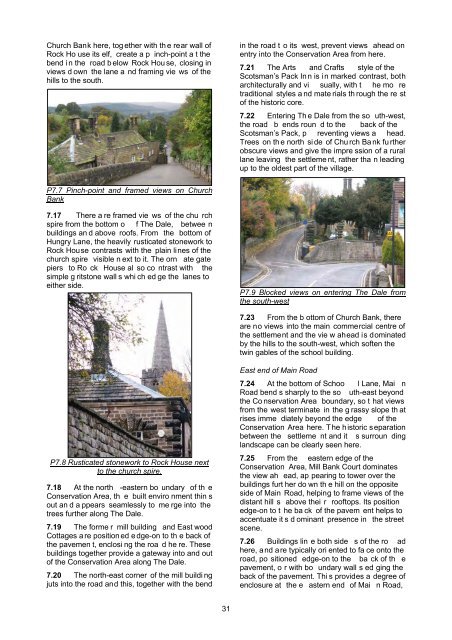
Church Bank here, tog ether with th e rear wall ofRock Ho use its elf, create a p inch-point a t thebend i n the road b elow Rock Hou se, closing inviews d own the lane a nd framing vie ws of thehills to the south.in the road t o its west, prevent views ahead onentry into the Conservation Area from here.7.21 The Arts and Crafts style of theScotsman’s Pack In n is i n marked contrast, botharchitecturally and vi sually, with t he mo retraditional styles a nd mate rials th rough the re stof the historic core.7.22 Entering Th e Dale from the so uth-west,the road b ends roun d to the back of theScotsman’s Pack, p reventing views a head.Trees on th e north si de of Chu rch Ba nk fu rtherobscure views and give the impre ssion of a rurallane leaving the settleme nt, rather tha n leadingup to the oldest part of the village.P7.7 Pinch-point and framed views on ChurchBank7.17 There a re framed vie ws of the chu rchspire from the bottom o f The Dale, betwee nbuildings an d above roofs. From the bottom ofHungry Lane, the heavily rusticated stonework toRock House contrasts with the plain lines of thechurch spire visible n ext to it. The orn ate gatepiers to Ro ck House al so co ntrast with thesimple g ritstone wall s whi ch ed ge the lanes toeither side.P7.9 Blocked views on entering The Dale fromthe south-west7.23 From the b ottom of Church Bank, thereare no views into the main commercial centre ofthe settlement and the vie w ahead is dominatedby the hills to the south-west, which soften thetwin gables of the school building.P7.8 Rusticated stonework to Rock House nextto the church spire.7.18 At the north -eastern bo undary of th eConservation Area, th e built enviro nment thin sout an d a ppears seamlessly to me rge into thetrees further along The Dale.7.19 The forme r mill building and East woodCottages a re position ed e dge-on to th e back ofthe pavemen t, enclosi ng the roa d he re. Thesebuildings together provide a gateway into and outof the Conservation Area along The Dale.7.20 The north-east corner of the mill buildi ngjuts into the road and this, together with the bendEast end of Main Road7.24 At the bottom of Schoo l Lane, Mai nRoad bend s sharply to the so uth-east beyondthe Co nservation Area boundary, so t hat viewsfrom the west terminate in the g rassy slope th atrises imme diately beyond the edge of theConservation Area here. The historic s eparationbetween the settleme nt and it s surroun dinglandscape can be clearly seen here.7.25 From the eastern edge of theConservation Area, Mill Bank Court dominatesthe view ah ead, ap pearing to tower over thebuildings furt her do wn th e hill on the oppositeside of Main Road, helping to frame views of thedistant hill s above thei r rooftops. Its positionedge-on to t he ba ck of the pavem ent helps toaccentuate it s d ominant presence in the streetscene.7.26 Buildings lin e both side s of the ro adhere, and are typically ori ented to fa ce onto theroad, po sitioned edge-on to the ba ck of th epavement, o r with bo undary wall s ed ging theback of the pavement. Thi s provides a degree ofenclosure at the e astern end of Mai n Road,31