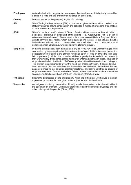
Pinch pointQuoinsA visual effect which suggests a narrowing of the street scene. It is typically caused bya bend in a road and the proximity of buildings on either side.Dressed stones at the (exterior) angles of a building.SBI Site of Biological Imp ortance (SBI) is the name given to the most imp ortant nonstatutorysites for nature conservation and provides a means of protecting sites that areof local interest and importance.SSSI Site of s pecial s cientific interes t. Sites of nation al importan ce for their wil dlife o rgeological interest, prot ected und er the Wildlife & Countryside Act 19 81 (an dsubsequent amend ments). Owners/o ccupiers must con sult Natural Engl and if theywish to carry out ope rations which mig ht damag e t he interest of the site, an d publi cbodies h ave a duty to take reasonable steps to further the co nservation an denhancement of SSSIs (e.g. when considering planning issues).Strip fieldTithe mapVernacularIn the Me dieval period, from at le ast as early as 1100 AD, Pe ak <strong>District</strong> villages weresurrounded by large strip fi elds (often referred to as ‘ open fields’ – in upland a reas it isdebatable whether some parts of them remain ed open for long an d thus the term stripfield is preferred). While o ften bounded at their edges by banks and ditches, internallythey were initially divided into a large number of unfenced cultivation strips. The use ofstrips allowed a fair distri bution of different grades of land between lord and villagers.This system was designed to favour the need s of arable cultivation. It seems to havebeen introduced into the area from the lowlands of th e Midlands. In the Pe ak <strong>District</strong>,pastoral farming was of equal or greater importance, and individual strips or parcels ofstrips were enclosed from an early date. Others, in less favourable locations in what areknown as ‘outfields’, may have only been used in an intermittent way.Shows the boundaries of land and property within the Tithe area. A tithe was a tenth ofa person’s produce or income given voluntarily or as a tax to the church.An indigenous building constructed of locally available materials, to local detail, withoutthe benefit of an architect. Vernacular architecture can be defined as dwellings and ‘allother buildings of the people’ (Oliver, 2003).54
15.0 REFERENCESBagshaw, S. (1846)Banks, F. R. (1975)Barnatt, J. (2003)Barnatt, J. & Smith, K. (2004)Brunskill, R. W. (2000)Buxton, B. A. (2005)Cameron, K. (1959)Hart, C. R. (1981)Hathersage Environment Group (2009)Hey, D. (2001)Kelly (1891)McGuire, S., Rodgers, H.,Stone, J. and Wilson, B. (2000)McMeeken, L.G. (1991)Mercer, E. (1975)Morris, J. (1987)Oliver, P. (2003)History, Gazetteer and Directory of Derbyshire. Sheffield.The <strong>Peak</strong> <strong>District</strong>. Robert Hale & Co., London.A Landscape Through Time: The Historic Character ofthe <strong>Peak</strong> <strong>District</strong> <strong>National</strong> <strong>Park</strong> Landscape, Aims,Methods and User Manual. <strong>Peak</strong> <strong>District</strong> Nation al <strong>Park</strong><strong>Authority</strong>.The <strong>Peak</strong> <strong>District</strong>: Landscapes Through Time. WindgatherPress Ltd., Cheshire.Vernacular Architecture. Faber and Faber Limited, London.Hathersage in the <strong>Peak</strong>: A History. Phillimore & Co. Ltd.,West Sussex.The Place Names of Derbyshire. Camb ridge UniversityPress.The North Derbyshire Archaeological Survey to A.D.1500. The North Derbyshire Arch aeological Tru st,Chesterfield.A Guided Walk Around the Village of Hathersage in theHope Valley. Historical Hathersage Millenium Project.Packmen, Carriers and Packhorse Roads. Landm arkPublishing Ltd., Derbyshire.Kelly’s Directory of Derbyshire.Hathersage: Images of the Past. Historical HathersageMillenium Project.A Companion to the <strong>Peak</strong> Villages….and beyond. Loui sMcMeeken, Buxton.English Vernacular Houses. Royal Commission on H istoricMonuments 21.Domesday Book - Derbyshire. Philip Morgan (ed.),Philimore (27), Chichester.Dwellings: The Vernacular House World Wide. Phaidon,London.Pevsner, N. (2002) The Buildings of England: Derbyshire. Revised byElizabeth Williamson. Yale University Press.Pigot (1835)Tarn, J. N. (1971)Other SourcesDerbyshire County Council ()Pigot and Co's Commercial Directory for Derbyshire.The <strong>Peak</strong> <strong>District</strong> and its Architecture. R.B. Macmillan Ltd,Derby.Heritage Environment Record for Derbyshire.Department of the EnvironmentList of Buildings of Special Architectural or HistoricInterest Vol. 356. <strong>District</strong> of West Derbyshire, <strong>Peak</strong> <strong>District</strong><strong>National</strong> <strong>Park</strong>. 1985English Heritage Brock, D Architectural Glossary, 1984.<strong>Peak</strong> <strong>District</strong> <strong>National</strong> <strong>Park</strong> <strong>Authority</strong> Local Plan, 2001.<strong>Peak</strong> <strong>District</strong> <strong>National</strong> <strong>Park</strong> <strong>Authority</strong> Design Guide, 2007.<strong>Peak</strong> <strong>District</strong> <strong>National</strong> <strong>Park</strong> <strong>Authority</strong> Landscape Strategy and Action Plan, 200955


