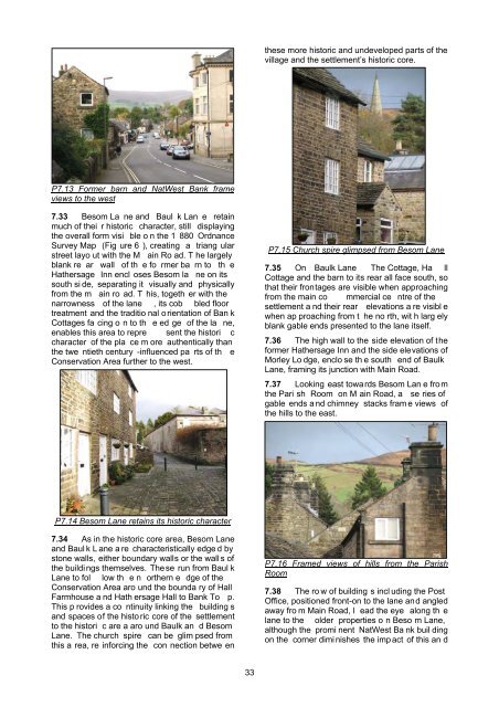
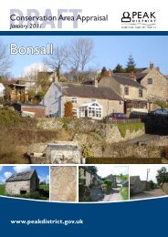
accentuated by the relative narroroad here.wness of thetermination to the south side of the road, with thehills beyond forming a backdrop.P7.12 View ahead is closed in and terminates ina wall of treesP7.10 Mill Bank Court appears to tower overbuildings down the hill7.27 Although development along Main Roadis line ar, sli ght bend s in t he ro ad at it s ea sternend mea n that building s appe ar to jut into theroad in places, rest ricting views of buildingsfurther d own the road a nd adding vari ety to thevista when moving from east to west.7.28 Main Road runs downhill beyondTopcroft so t hat there a re long-ranging views ofthe hills to t he west an d south-west over therooftops of properties fu rther down t he ro ad.From the e ast, these vie ws a re fra med by thegable end of Topcroft, whic h faces up the road.The rend ered fronta ge of Broo k Cotta ge at thebottom of the hill fa ces up Main Road,terminating the vista from the east.P7.11 Topcroft frames views of hills7.29 From Morley Lodge, the view to the eastis closed in by a series of ga ble ends offsetbehind ea ch other alon g the no rth side of themain roa d, and by the north-east corne r ofTopcroft, angled in towards the road, so that theview ahea d appe ars to termin ate in the wall oftrees above Hall Farm. The tall Mill Bank Courtbuilding, at the top of the hill, provides a visual7.30 The long-standing agricultural complexeswhich, until recently, made a significantcontribution to the histori c ch aracter a ndappearance of the main route throughHathersage, have now bee n converted toresidential use. Ibbot son’s Fa rm was the mo stcentral of the histori c farms, and its buil dings aremore p rominent in the street scene, being setcloser to the roa d ed ge t han the othe r form erfarm com plexes. The main farm buildings,converted si nce the Conservation A rea wasdesignated, now retain o nly a few fe atures todisclose th eir agri cultural origins and the g ableends of the forme r b arn at the western end,which was o riginally p ositioned edge on to theroad itself, were foreshortened to make way for apavement, reducing the sense of enclosure here.Although th ese changes have la rgely rem ovedthe histo ric agri cultural cha racter of theConservation Area at thi s point, the main farmbuildings still retain their hi storic physi calrelationship to the publi c domain, facing the roadand positioned close to its edge.7.31 The former Hathe rsage Inn and MillBank buildings are considerably larger than mostof the buildin gs ne arby a nd further to t he ea st,but s till reflec t the loc al v ernacular, constructedusing local m aterials, in a traditional style. As aresult, these buildings sit harmoniously within thestreet scen e. In contra st, the e arly t wentiethcentury Nat West Ban k building i s constructedusing large ashlar blocks of stone and its scale,style and d etailing do not follow t he localvernacular, so that it do minates views along theroad in both dire ctions, adding a sub urban towncentre element in sharp contrast to the traditionalvernacular of the settlement.7.32 The gable end to the fo rmer barn at th ewestern en d of Ibbot son’s Fa rm and the tallNatWest building on th e so uth side of MainRoad, together frame views through to the westside of the Conservation Area and the hillsbeyond.32
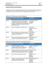
these more historic and undeveloped parts of thevillage and the settlement’s historic core.P7.13 Former barn and NatWest Bank frameviews to the west7.33 Besom La ne and Baul k Lan e retainmuch of thei r historic character, still displayingthe overall form visi ble o n the 1 880 OrdnanceSurvey Map (Fig ure 6 ), creating a triang ularstreet layo ut with the M ain Ro ad. T he largelyblank re ar wall of th e fo rmer ba rn to th eHathersage Inn encl oses Besom la ne on itssouth si de, separating it visually and physicallyfrom the m ain ro ad. T his, togeth er with thenarrowness of the lane , its cob bled floortreatment and the traditio nal orientation of Ban kCottages fa cing o n to th e ed ge of the la ne,enables this area to repre sent the histori ccharacter of the pla ce m ore authentically thanthe twe ntieth century -influenced pa rts of th eConservation Area further to the west.P7.15 Church spire glimpsed from Besom Lane7.35 On Baulk Lane The Cottage, Ha llCottage and the barn to its rear all face south, sothat their frontages are visible when approachingfrom the main co mmercial ce ntre of thesettlement a nd their rear elevations a re visibl ewhen ap proaching from t he no rth, wit h larg elyblank gable ends presented to the lane itself.7.36 The high wall to the side elevation of theformer Hathersage Inn and the side elevations ofMorley Lo dge, enclo se th e south end of BaulkLane, framing its junction with Main Road.7.37 Looking east towards Besom Lan e fromthe Pari sh Room on M ain Road, a se ries ofgable ends a nd chimney stacks fram e views ofthe hills to the east.P7.14 Besom Lane retains its historic character7.34 As in the historic core area, Besom Laneand Baul k L ane a re characteristically edge d bystone walls, either boundary walls or the wall s ofthe buildings themselves. These run from Baul kLane to fol low th e n orthern e dge of theConservation Area aro und the bounda ry of HallFarmhouse a nd Hath ersage Hall to Bank To p.This p rovides a co ntinuity linking the building sand spaces of the histo ric core of the settlementto the histori c are a aro und Baulk an d BesomLane. The church spire can be glim psed fromthis a rea, re inforcing the con nection betwe enP7.16 Framed views of hills from the ParishRoom7.38 The ro w of building s incl uding the PostOffice, positioned front-on to the lane and angledaway fro m Main Road, l ead the eye along th elane to the older properties o n Beso m Lane,although the promi nent NatWest Ba nk buil dingon the corner dimi nishes the imp act of this an d33