Appendix - Peak District National Park Authority
Appendix - Peak District National Park Authority
Appendix - Peak District National Park Authority

Create successful ePaper yourself
Turn your PDF publications into a flip-book with our unique Google optimized e-Paper software.
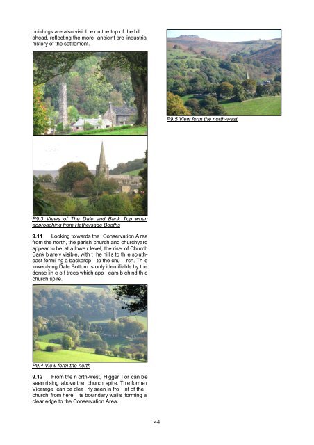
uildings are also visibl e on the top of the hillahead, reflecting the more ancient pre-industrialhistory of the settlement.P9.5 View form the north-westP9.3 Views of The Dale and Bank Top whenapproaching from Hathersage Booths9.11 Looking to wards the Conservation A reafrom the north, the parish church and churchyardappear to be at a lowe r level, the rise of ChurchBank b arely visible, with t he hill s to th e so utheastformi ng a backdrop to the chu rch. Th elower-lying Dale Bottom is only identifiable by thedense lin e o f trees which app ears b ehind th echurch spire.P9.4 View form the north9.12 From the n orth-west, Higger Tor can beseen ri sing above the church spire. Th e forme rVicarage can be clea rly seen in fro nt of thechurch from here, its bou ndary wall s forming aclear edge to the Conservation Area.44