

Understanding Map Projections
Understanding Map Projections
Understanding Map Projections
- No tags were found...

Create successful ePaper yourself
Turn your PDF publications into a flip-book with our unique Google optimized e-Paper software.
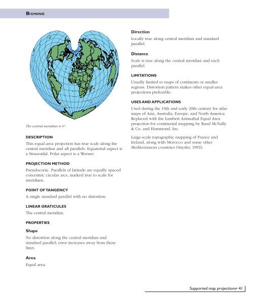
BONNEDirectionLocally true along central meridian and standardparallel.DistanceScale is true along the central meridian and eachparallel.LIMITATIONSUsually limited to maps of continents or smallerregions. Distortion pattern makes other equal-areaprojections preferable.The central meridian is 0°.DESCRIPTIONThis equal-area projection has true scale along thecentral meridian and all parallels. Equatorial aspect isa Sinusoidal. Polar aspect is a Werner.USES AND APPLICATIONSUsed during the 19th and early 20th century for atlasmaps of Asia, Australia, Europe, and North America.Replaced with the Lambert Azimuthal Equal Areaprojection for continental mapping by Rand McNally& Co. and Hammond, Inc.Large-scale topographic mapping of France andIreland, along with Morocco and some otherMediterranean countries (Snyder, 1993).PROJECTION METHODPseudoconic. Parallels of latitude are equally spacedconcentric circular arcs, marked true to scale formeridians.POINT OF TANGENCYA single standard parallel with no distortion.LINEAR GRATICULESThe central meridian.PROPERTIESShapeNo distortion along the central meridian andstandard parallel; error increases away from theselines.AreaEqual area.Supported map projections• 41


