Understanding Map Projections
Understanding Map Projections
Understanding Map Projections
- No tags were found...
Create successful ePaper yourself
Turn your PDF publications into a flip-book with our unique Google optimized e-Paper software.
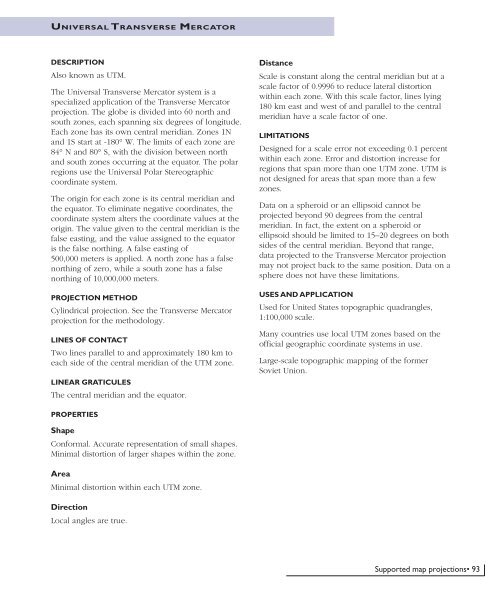
UNIVERSAL T RANSVERSE MERCATORDESCRIPTIONAlso known as UTM.The Universal Transverse Mercator system is aspecialized application of the Transverse Mercatorprojection. The globe is divided into 60 north andsouth zones, each spanning six degrees of longitude.Each zone has its own central meridian. Zones 1Nand 1S start at -180° W. The limits of each zone are84° N and 80° S, with the division between northand south zones occurring at the equator. The polarregions use the Universal Polar Stereographiccoordinate system.The origin for each zone is its central meridian andthe equator. To eliminate negative coordinates, thecoordinate system alters the coordinate values at theorigin. The value given to the central meridian is thefalse easting, and the value assigned to the equatoris the false northing. A false easting of500,000 meters is applied. A north zone has a falsenorthing of zero, while a south zone has a falsenorthing of 10,000,000 meters.PROJECTION METHODCylindrical projection. See the Transverse Mercatorprojection for the methodology.LINES OF CONTACTTwo lines parallel to and approximately 180 km toeach side of the central meridian of the UTM zone.LINEAR GRATICULESThe central meridian and the equator.DistanceScale is constant along the central meridian but at ascale factor of 0.9996 to reduce lateral distortionwithin each zone. With this scale factor, lines lying180 km east and west of and parallel to the centralmeridian have a scale factor of one.LIMITATIONSDesigned for a scale error not exceeding 0.1 percentwithin each zone. Error and distortion increase forregions that span more than one UTM zone. UTM isnot designed for areas that span more than a fewzones.Data on a spheroid or an ellipsoid cannot beprojected beyond 90 degrees from the centralmeridian. In fact, the extent on a spheroid orellipsoid should be limited to 15–20 degrees on bothsides of the central meridian. Beyond that range,data projected to the Transverse Mercator projectionmay not project back to the same position. Data on asphere does not have these limitations.USES AND APPLICATIONUsed for United States topographic quadrangles,1:100,000 scale.Many countries use local UTM zones based on theofficial geographic coordinate systems in use.Large-scale topographic mapping of the formerSoviet Union.PROPERTIESShapeConformal. Accurate representation of small shapes.Minimal distortion of larger shapes within the zone.AreaMinimal distortion within each UTM zone.DirectionLocal angles are true.Supported map projections• 93


