

Understanding Map Projections
Understanding Map Projections
Understanding Map Projections
- No tags were found...

Create successful ePaper yourself
Turn your PDF publications into a flip-book with our unique Google optimized e-Paper software.
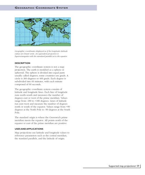
GEOGRAPHIC COORDINATE SYSTEMGeographic coordinates displayed as if the longitude–latitudevalues are linear units. An equivalent projection isEquirectangular with the standard parallel set to the equator.DESCRIPTIONThe geographic coordinate system is not a mapprojection. The earth is modeled as a sphere orspheroid. The sphere is divided into equal partsusually called degrees; some countries use grads. Acircle is 360 degrees or 400 grads. Each degree issubdivided into 60 minutes, with each minutecomposed of 60 seconds.The geographic coordinate system consists oflatitude and longitude lines. Each line of longituderuns north–south and measures the number ofdegrees east or west of the prime meridian. Valuesrange from -180 to +180 degrees. Lines of latituderun east–west and measure the number of degreesnorth or south of the equator. Values range from +90degrees at the North Pole to -90 degrees at the SouthPole.The standard origin is where the Greenwich primemeridian meets the equator. All points north of theequator or east of the prime meridian are positive.USES AND APPLICATIONS<strong>Map</strong> projections use latitude and longitude values toreference parameters such as the central meridian,the standard parallels, and the latitude of origin.Supported map projections• 59


