

Understanding Map Projections
Understanding Map Projections
Understanding Map Projections
- No tags were found...

Create successful ePaper yourself
Turn your PDF publications into a flip-book with our unique Google optimized e-Paper software.
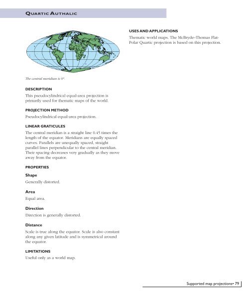
QUARTIC A UTHALICUSES AND APPLICATIONSThematic world maps. The McBryde–Thomas Flat-Polar Quartic projection is based on this projection.The central meridian is 0°.DESCRIPTIONThis pseudocylindrical equal-area projection isprimarily used for thematic maps of the world.PROJECTION METHODPseudocylindrical equal-area projection.LINEAR GRATICULESThe central meridian is a straight line 0.45 times thelength of the equator. Meridians are equally spacedcurves. Parallels are unequally spaced, straightparallel lines perpendicular to the central meridian.Their spacing decreases very gradually as they moveaway from the equator.PROPERTIESShapeGenerally distorted.AreaEqual area.DirectionDirection is generally distorted.DistanceScale is true along the equator. Scale is also constantalong any given latitude and is symmetrical aroundthe equator.LIMITATIONSUseful only as a world map.Supported map projections• 79


