

Understanding Map Projections
Understanding Map Projections
Understanding Map Projections
- No tags were found...

Create successful ePaper yourself
Turn your PDF publications into a flip-book with our unique Google optimized e-Paper software.
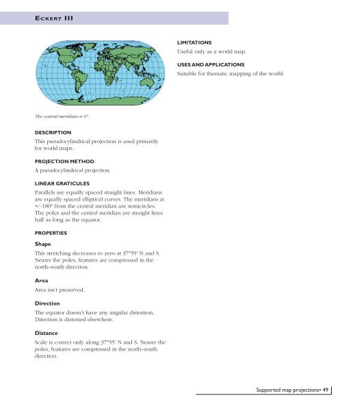
ECKERT IIILIMITATIONSUseful only as a world map.USES AND APPLICATIONSSuitable for thematic mapping of the world.The central meridian is 0°.DESCRIPTIONThis pseudocylindrical projection is used primarilyfor world maps.PROJECTION METHODA pseudocylindrical projection.LINEAR GRATICULESParallels are equally spaced straight lines. Meridiansare equally spaced elliptical curves. The meridians at+/-180° from the central meridian are semicircles.The poles and the central meridian are straight lineshalf as long as the equator.PROPERTIESShapeThis stretching decreases to zero at 37°55' N and S.Nearer the poles, features are compressed in thenorth–south direction.AreaArea isn’t preserved.DirectionThe equator doesn’t have any angular distortion.Direction is distorted elsewhere.DistanceScale is correct only along 37°55' N and S. Nearer thepoles, features are compressed in the north–southdirection.Supported map projections• 49


