

Understanding Map Projections
Understanding Map Projections
Understanding Map Projections
- No tags were found...

You also want an ePaper? Increase the reach of your titles
YUMPU automatically turns print PDFs into web optimized ePapers that Google loves.
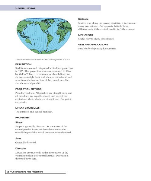
LOXIMUTHALDistanceScale is true along the central meridian. It is constantalong any latitude. The opposite latitude has adifferent scale if the central parallel isn’t the equator.LIMITATIONSUseful only to show loxodromes.USES AND APPLICATIONSSuitable for displaying loxodromes.The central meridian is 100° W. The central parallel is 60° N.DESCRIPTIONKarl Siemon created this pseudocylindrical projectionin 1935. This projection was also presented in 1966by Waldo Tobler. Loxodromes, or rhumb lines, areshown as straight lines with the correct azimuth andscale from the intersection of the central meridianand the central parallel.PROJECTION METHODPseudocylindrical. All parallels are straight lines, andall meridians are equally spaced arcs except thecentral meridian, which is a straight line. The polesare points.LINEAR GRATICULESThe parallels and central meridian.PROPERTIESShapeShape is generally distorted. As the value of thecentral parallel increases from the equator, theoverall shape of the world becomes more distorted.AreaGenerally distorted.DirectionDirections are true only at the intersection of thecentral meridian and central latitude. Direction isdistorted elsewhere.68 • <strong>Understanding</strong> <strong>Map</strong> <strong>Projections</strong>


