

Uranium ore-forming systems of the - Geoscience Australia
Uranium ore-forming systems of the - Geoscience Australia
Uranium ore-forming systems of the - Geoscience Australia

You also want an ePaper? Increase the reach of your titles
YUMPU automatically turns print PDFs into web optimized ePapers that Google loves.
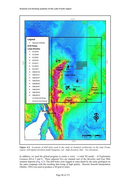
<strong>Uranium</strong> <strong>ore</strong>-<strong>forming</strong> <strong>systems</strong> <strong>of</strong> <strong>the</strong> Lake Frome regionFigure 4.2: Locations <strong>of</strong> drill holes used in <strong>the</strong> study <strong>of</strong> chemical architecture in <strong>the</strong> Lake Fromeregion, with digital elevation model (magenta, red – high elevation, blue – low elevation).In addition, we used <strong>the</strong> gOcad program to create a voxet – a solid 3D model – <strong>of</strong> ExplorationLicences (ELs) 5 and 6. These adjacent ELs are situated east <strong>of</strong> <strong>the</strong> Beverley and Four Mileuranium deposits (Fig. 4.2). The drill holes were logged in some detail by <strong>the</strong> same geologists on<strong>the</strong> same campaign with <strong>the</strong> resulting data being <strong>of</strong> high quality. Discrete Smooth Interpolation(Mallet, 1992) was used to produce a 3D grid <strong>of</strong> redox.Page 46 <strong>of</strong> 151


