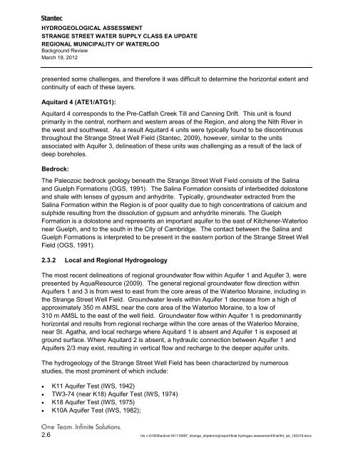
HYDROGEOLOGICAL ASSESSMENTSTRANGE STREET WATER SUPPLY CLASS EA UPDATEREGIONAL MUNICIPALITY OF WATERLOOBackground ReviewMarch 19, 2012presented some challenges, and therefore it was difficult to determine the horizontal extent andcontinuity <strong>of</strong> each <strong>of</strong> these layers.Aquitard 4 (ATE1/ATG1):Aquitard 4 corresponds to the Pre-Catfish Creek Till and Canning Drift. This unit is foundprimarily in the central, northern and western areas <strong>of</strong> the <strong>Region</strong>, and along the Nith River inthe west and southwest. As a result Aquitard 4 units were typically found to be discontinuousthroughout the Strange Street Well Field (Stantec, 2009), however, similar to the unitsassociated with Aquifer 3, delineation <strong>of</strong> these units was challenging as a result <strong>of</strong> the lack <strong>of</strong>deep boreholes.Bedrock:The Paleozoic bedrock geology beneath the Strange Street Well Field consists <strong>of</strong> the Salinaand Guelph Formations (OGS, 1991). The Salina Formation consists <strong>of</strong> interbedded dolostoneand shale with lenses <strong>of</strong> gypsum and anhydrite. Typically, groundwater extracted from theSalina Formation within the <strong>Region</strong> is <strong>of</strong> poor quality due to high concentrations <strong>of</strong> calcium andsulphide resulting from the dissolution <strong>of</strong> gypsum and anhydrite minerals. The GuelphFormation is a dolostone and represents an important aquifer to the east <strong>of</strong> Kitchener-<strong>Waterloo</strong>near Guelph, and to the south in the City <strong>of</strong> Cambridge. The contact between the Salina andGuelph Formations is interpreted to be present in the eastern portion <strong>of</strong> the Strange Street WellField (OGS, 1991).2.3.2 Local and <strong>Region</strong>al HydrogeologyThe most recent delineations <strong>of</strong> regional groundwater flow within Aquifer 1 and Aquifer 3, werepresented by AquaResource (2009). The general regional groundwater flow direction withinAquifers 1 and 3 is from west to east from the core areas <strong>of</strong> the <strong>Waterloo</strong> Moraine, including inthe Strange Street Well Field. Groundwater levels within Aquifer 1 decrease from a high <strong>of</strong>approximately 350 m AMSL near the core area <strong>of</strong> the <strong>Waterloo</strong> Moraine, to a low <strong>of</strong>310 m AMSL to the east <strong>of</strong> the well field. Groundwater flow within Aquifer 1 is predominantlyhorizontal and results from regional recharge within the core areas <strong>of</strong> the <strong>Waterloo</strong> Moraine,near St. Agatha, and local recharge where Aquitard 1 is absent and Aquifer 1 is exposed atground surface. Where Aquitard 2 is absent, a hydraulic connection between Aquifer 1 andAquifers 2/3 may exist, resulting in vertical flow and recharge to the deeper aquifer units.The hydrogeology <strong>of</strong> the Strange Street Well Field has been characterized by numerousstudies, the most prominent <strong>of</strong> which include:• K11 Aquifer Test (IWS, 1942)• TW3-74 (near K18) Aquifer Test (IWS, 1974)• K18 Aquifer Test (IWS, 1975)• K10A Aquifer Test (IWS, 1982);2.6 hls v:\01609\active\161110897_strange_st\planning\report\final hydrogeo assessment\final\fnl_rpt_120319.docx
HYDROGEOLOGICAL ASSESSMENTSTRANGE STREET WATER SUPPLY CLASS EA UPDATEREGIONAL MUNICIPALITY OF WATERLOOBackground ReviewMarch 19, 2012• Aquifer Shutdown Test (Terraqua, 1995);• Kitchener Westside Pumping Test (Stantec, 2000);• K19 Aquifer Test (Stantec, 2005);• K11A Aquifer Test (Burnside, 2007);• Mapping <strong>of</strong> Shallow and Deep Potentiometric Surfaces (AquaResource, 2009); and• Tier 3 Water Budget and Water Quality Risk Assessment (Stantec, 2009).Groundwater flow within the Strange Street Well Field follows the general regional trendsdescribed above, with the predominant flow direction within Aquifer 1 being from west to east.Groundwater flow under pumping and non-pumping conditions was recently investigated and asummary <strong>of</strong> all previous reports can be found within the Tier 3 Water Budget and Water QualityRisk Assessment Report (Stantec, 2009).The recharge source area for the Strange Street Well Field was evaluated in Terraqua (1995).Terraqua (1995) concluded that the water captured by the well field is recharged locally.2.4 WELL FIELD DESCRIPTIONThe Strange Street Well Field is located within the northwest portion <strong>of</strong> the City <strong>of</strong> Kitchener andis generally spread out over an area <strong>of</strong> approximately 1.0 km 2 . The well field is divided into twogeneral areas. Production Wells K11A, K13, K18 and K19 are located in the western portion <strong>of</strong>the well field, in the vicinity <strong>of</strong> the Westmount Golf & Country Club (Figure 1). With theexception <strong>of</strong> the golf course, which is zoned as open space, land use in this area ispredominantly residential. Production Well K10A is located approximately 1 kilometer (km) tothe east on Gage Avenue within an area that is zoned as industrial/mixed use with residentialintermixed (Figure 1).The first wells for the Strange Street Well Field were constructed around 1910 and a pumpingstation was constructed in 1923. By the time the pumping station was constructed, there wereat least (9) wells installed to depths ranging from 14 m to 91 m below ground surface (BGS).The water supply for the Strange Street Well Field is currently obtained from Production WellsK10A, K11A, K13, K18 and K19. Production Wells K10, K11, K12, K14, K14A, K15, K16 andK17, which have been used historically for water supply purposes, have either been abandonedor replaced due to poor water quality or a decline in well yield. A detailed history <strong>of</strong> the StrangeStreet Well Field was documented in Stantec (2000). The following provides a brief summary <strong>of</strong>the status <strong>of</strong> the currently active production wells:• Production Well K10 was constructed following a test drilling program in 1935, and wasabandoned as a water supply source following the construction <strong>of</strong> Production Well K10A in1982. Production Well K10A is currently used as a water supply source;hls v:\01609\active\161110897_strange_st\planning\report\final hydrogeo assessment\final\fnl_rpt_120319.docx 2.7
- Page 2 and 3: August 26, 2011Sam ZiemannPage 2 of
- Page 4 and 5: August 26, 2011Sam ZiemannPage 4 of
- Page 6 and 7: August 26, 2011Sam ZiemannPage 6 of
- Page 8 and 9: August 26, 2011Sam ZiemannPage 8 of
- Page 10 and 11: August 26, 2011Sam ZiemannPage 10 o
- Page 12 and 13: August 26, 2011Sam ZiemannPage 12 o
- Page 14 and 15: Pressure (kPa)K18/K19 Well House to
- Page 16 and 17: Figure 4a - Existing ConditionsPump
- Page 18 and 19: Figure 6a - Existing System w/Combi
- Page 20 and 21: Figure 8a - Existing ConditionsWell
- Page 22 and 23: Figure 10a - Future System w/Combin
- Page 24 and 25: MD-80 CATALYTIC MEDIAIRON, MANGANES
- Page 26 and 27: NR - Pressure FiltersHorizontal and
- Page 28 and 29: Napier-Reid Ltd.Pressure FiltersSal
- Page 30 and 31: APPENDIX EHydrogeological Assessmen
- Page 32 and 33: HYDROGEOLOGICAL ASSESSMENTSTRANGE S
- Page 34 and 35: HYDROGEOLOGICAL ASSESSMENTSTRANGE S
- Page 36 and 37: HYDROGEOLOGICAL ASSESSMENTSTRANGE S
- Page 38 and 39: HYDROGEOLOGICAL ASSESSMENTSTRANGE S
- Page 40 and 41: HYDROGEOLOGICAL ASSESSMENTSTRANGE S
- Page 44 and 45: HYDROGEOLOGICAL ASSESSMENTSTRANGE S
- Page 46 and 47: HYDROGEOLOGICAL ASSESSMENTSTRANGE S
- Page 48 and 49: HYDROGEOLOGICAL ASSESSMENTSTRANGE S
- Page 50 and 51: HYDROGEOLOGICAL ASSESSMENTSTRANGE S
- Page 52 and 53: HYDROGEOLOGICAL ASSESSMENTSTRANGE S
- Page 54 and 55: HYDROGEOLOGICAL ASSESSMENTSTRANGE S
- Page 56 and 57: HYDROGEOLOGICAL ASSESSMENTSTRANGE S
- Page 58 and 59: HYDROGEOLOGICAL ASSESSMENTSTRANGE S
- Page 60 and 61: HYDROGEOLOGICAL ASSESSMENTSTRANGE S
- Page 62 and 63: HYDROGEOLOGICAL ASSESSMENTSTRANGE S
- Page 64 and 65: HYDROGEOLOGICAL ASSESSMENTSTRANGE S
- Page 66 and 67: HYDROGEOLOGICAL ASSESSMENTSTRANGE S
- Page 68 and 69: HYDROGEOLOGICAL ASSESSMENTSTRANGE S
- Page 70: HYDROGEOLOGICAL ASSESSMENTSTRANGE S
- Page 78 and 79: 25Pumping Rate20Pumping Rate (L/s)1
- Page 80 and 81: HYDROGEOLOGICAL ASSESSMENTSTRANGE S
- Page 82 and 83: TABLE 2SUMMARY OF GROUNDWATER ANALY
- Page 84 and 85: CALCULATION OF SPECIFIC CAPACITY FR
- Page 111 and 112:
March 2, 2011Reference: 006-189Stan
- Page 113 and 114:
TABLE 1REGIONAL MUNICIPALITY OF WAT
- Page 132 and 133:
HYDROGEOLOGICAL ASSESSMENTSTRANGE S
- Page 134 and 135:
July 23, 2010Lisa Lachuta, P.Eng.Pa
- Page 136 and 137:
July 23, 2010Lisa Lachuta, P.Eng.Pa
- Page 138 and 139:
July 23, 2010Lisa Lachuta, P.Eng.Pa
- Page 140:
TECHNICAL MEMORANDUM A1 -STRANGE ST
- Page 143 and 144:
TECHNICAL MEMORANDUM A1 -STRANGE ST
- Page 145:
TABLE 1SUMMARY OF GROUNDWATER ANALY


