International Symposium on Mitigative Measures against Snow ...
International Symposium on Mitigative Measures against Snow ...
International Symposium on Mitigative Measures against Snow ...

Create successful ePaper yourself
Turn your PDF publications into a flip-book with our unique Google optimized e-Paper software.
<str<strong>on</strong>g>Internati<strong>on</strong>al</str<strong>on</strong>g> <str<strong>on</strong>g>Symposium</str<strong>on</strong>g> <strong>on</strong> <strong>Mitigative</strong> <strong>Measures</strong> <strong>against</strong> <strong>Snow</strong> Avalanches<br />
Egilsstaðir, Iceland, March 11–14, 2008<br />
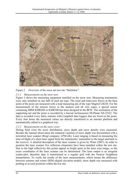
Figure 2 Overview of the snow net test site “Hafelekar”.<br />
2.1.1 Measurements <strong>on</strong> the snow nets<br />
Figure 3 shows the measuring equipment installed <strong>on</strong> the snow nets. Measuring instruments<br />
were <strong>on</strong>ly installed <strong>on</strong> <strong>on</strong>e half of each net type. The axial and transverse forces in the base<br />
point of the posts are measured with a load measuring pin of the type Magtrol LB236. For the<br />
measurement of the tensi<strong>on</strong> forces in the anchors and all wire ropes, a special sensor<br />
c<strong>on</strong>taining HBM KMR200 or KMR300 has been designed at the BFW. The inclinati<strong>on</strong> of the<br />
supporting net and the posts is recorded by a biaxial inclinosensor HLPlanar NS-25/E2. The<br />
data is recorded every thirty minutes with Campbell data loggers that are fixed <strong>on</strong> the posts.<br />
Every four hours the measured values are directly transferred to an internet platform and<br />
automatically edited in a graphical way.<br />
2.1.2 Measurements <strong>on</strong> the snow cover<br />
During field visits the snow distributi<strong>on</strong>, snow depth and snow density were measured.<br />
Besides the manual observati<strong>on</strong> the temporal variati<strong>on</strong> of snow depth was documented with a<br />
terrestrial laser scanner (Riegl company, LPM-i2k). Laser ranging is based <strong>on</strong> measuring the<br />
time-of-flight of a short laser signal from the instruments’ transmitter to the target and back to<br />
the receiver. A detailed descripti<strong>on</strong> of the laser scanner is given by Wiatr (2007). In order to<br />
positi<strong>on</strong> the laser scanner five reflectors (tiepoints) have been installed within the test site.<br />
Due to the high reflectivity this points appear as bright spots in the laser scan image, so the<br />
exact coordinates of the laser scanner can be determined. The laser output is an irregular<br />
scatter-plot, therefore data is transformed to a regular grid with the Nearest Neighbour<br />
interpolati<strong>on</strong>. To verify the results of the laser measurements, which means the difference<br />
between summer and winter DEM (digital elevati<strong>on</strong> model), snow depth was measured with<br />
probing at several positi<strong>on</strong>s within the test site.<br />
42 <strong>Snow</strong> loads <strong>on</strong> defensive snow net systems