Goose Creek Watershed Management Plan Version - Charlotte ...
Goose Creek Watershed Management Plan Version - Charlotte ...
Goose Creek Watershed Management Plan Version - Charlotte ...

You also want an ePaper? Increase the reach of your titles
YUMPU automatically turns print PDFs into web optimized ePapers that Google loves.
<strong>Goose</strong> <strong>Creek</strong> <strong>Watershed</strong> <strong>Management</strong> <strong>Plan</strong> <strong>Version</strong> 1...………………...October 31, 2009<br />
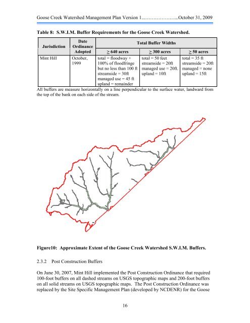
Table 8: S.W.I.M. Buffer Requirements for the <strong>Goose</strong> <strong>Creek</strong> <strong>Watershed</strong>.<br />
Jurisdiction<br />
Mint Hill<br />
Date<br />
Ordinance<br />
Adopted<br />
October,<br />
1999<br />
16<br />
Total Buffer Widths<br />
> 640 acres > 300 acres > 50 acres<br />
total = floodway +<br />
100% of floodfringe<br />
but no less than 100 ft<br />
streamside = 30ft<br />
managed use = 45 ft<br />
upland = remainder<br />
total = 50 feet<br />
streamside = 20ft<br />
managed use = 20ft.<br />
upland = 10ft<br />
total = 35 ft<br />
streamside = 20ft<br />
managed = none<br />
upland = 15ft<br />
All buffers are measure horizontally on a line perpendicular to the surface water, landward from<br />
the top of the bank on each side of the stream.<br />
Figure10: Approximate Extent of the <strong>Goose</strong> <strong>Creek</strong> <strong>Watershed</strong> S.W.I.M. Buffers.<br />
2.3.2 Post Construction Buffers<br />
On June 30, 2007, Mint Hill implemented the Post Construction Ordinance that required<br />
100-foot buffers on all dashed streams on USGS topographic maps and 200-foot buffers<br />
on all solid streams on USGS topographic maps. The Post Construction Ordinance was<br />
replaced by the Site Specific <strong>Management</strong> <strong>Plan</strong> (developed by NCDENR) for the <strong>Goose</strong>