Stirring Up a Hornet's Nest: - UGA Laboratory of Archaeology ...
Stirring Up a Hornet's Nest: - UGA Laboratory of Archaeology ...
Stirring Up a Hornet's Nest: - UGA Laboratory of Archaeology ...

Create successful ePaper yourself
Turn your PDF publications into a flip-book with our unique Google optimized e-Paper software.
The GPS locations <strong>of</strong> suspected sites were recorded so that they could be revisited during secondary<br />
reconnaissance survey.<br />
Several historic farmsteads were located by this method and team members conducted a preliminary search<br />
<strong>of</strong> these sites with the metal detector. The project’s time and resources did not allow complete examination<br />
<strong>of</strong> all <strong>of</strong> these finds. Several <strong>of</strong> these home sites contain vast amounts <strong>of</strong> metal, which rendered the metal<br />
detector strategy ineffective. These homes are likely <strong>of</strong> late 19 th or early 20 th century vintage, since<br />
abundant metal debris is typical on these types <strong>of</strong> sites. What is not known, however, is whether these sites<br />
mask an earlier historic occupation or site use.<br />
For the secondary reconnaissance survey, a larger group <strong>of</strong> metal detector operators were organized and<br />
coordinated by the Field Director. Highly skilled operators were interspersed with those with less<br />
experience. The operators were assigned transects or sectors <strong>of</strong> sites or landforms to cover. On homestead<br />
sites the sector method was used, whereas transects were used to cover areas <strong>of</strong> slope where Revolutionary<br />
War period metal relics had been previously identified by the preliminary reconnaissance team.<br />
Once a significant metal find was located, its location was recorded, either by the Sokkia total station or<br />
with a GPS handheld receiver. UTM locations were recorded for each find using the NAD 27 datum<br />
reference. These Northing and Easting metric geographic coordinates were shortened for convenience by<br />
dropping the first two digits <strong>of</strong> the Easting and first three digits <strong>of</strong> the Northing reading. For example, an<br />
object located at UTM, Zone 17, 3729226 Northing, 325270 Easting, was given the grid coordinates: 9226<br />
North, 5270 East. Both sets <strong>of</strong> coordinates are included in Appendix I. When the mapping process was<br />
delayed or backlogged, metal pin flags were used to mark the location <strong>of</strong> the finds. Each find was assigned<br />
a unique “Piece Plot”, or PP# numerical designation. These piece plot numbers served to identify each find<br />
throughout the field survey and laboratory analysis phase.<br />
A total <strong>of</strong> 86 artifacts from various survey locations was either not excavated or uncovered and left in<br />
place. Those left in place were duly noted in the field inventory with the notation “nc” (no collection) in the<br />
artifact inventory in Appendix I. Site loci and artifact locations were recorded using a combination <strong>of</strong><br />
Garmin GPS handheld devices and a Sokkia Total Station with a TDS Recon data collector.<br />
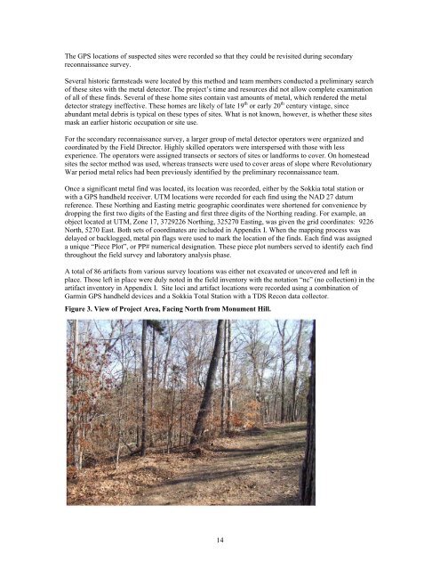
Figure 3. View <strong>of</strong> Project Area, Facing North from Monument Hill.<br />
14