V-C. Critères <strong>de</strong> progrès Le but <strong>de</strong> l’OSU est <strong>de</strong> favoriser la synergie et la mise en commun <strong>de</strong>s moyens <strong>de</strong> la R<strong>echerche</strong> et <strong>de</strong> l’Observation, ou <strong>de</strong>s <strong>de</strong>man<strong>de</strong>s <strong>de</strong> moyens nécessaires. De bons indicateurs à 5 ans <strong>de</strong>vront rendre compte du succès <strong>de</strong> cette synergie, c'est-à-dire montrer ce qui n’aurait pu être fait sans cette convergence. Trois indicateurs semblent pertinents : • Les <strong>de</strong>man<strong>de</strong>s <strong>de</strong> moyens aux programmes nationaux et internationaux portés par l’OSU : nombre <strong>de</strong> <strong>de</strong>man<strong>de</strong>s et nombre <strong>de</strong> projets financés • Les <strong>de</strong>man<strong>de</strong>s d’équipement mutualisés portés par l’OSU, notamment auprès <strong>de</strong> l’INSU, mais aussi <strong>de</strong>s acteurs locaux, notamment les communautés territoriales • La production scientifique en rapport directe avec la mutualisation, et notamment la production <strong>de</strong>s bases <strong>de</strong> données ouvertes • La production scientifique <strong>de</strong> la communauté via l’utilisation <strong>de</strong>s bases <strong>de</strong> données réalisées par l’OSU (nombre <strong>de</strong> consultations). 93
VI. Bibliographie Hydrology in Mediterranean and semi-arid regions. IAHS Publication, 2003. 278, 498+ xiv pp. Blon<strong>de</strong>l, J. and Aronson, J., 1999. Biology and wildlife of the Mediterranean region. Oxford University Press, Oxford, 328 pp. Daeron, M. et al., 2007. 12,000-year-long record of 10 to 13 paleoearthquakes on the Yammouneh Fault, Levant fault system, Lebanon. Bulletin of the Seismological Society of America, 97(3): 749- 771. GIEC, 2007. Bilan 2007 <strong>de</strong>s changements climatiques :Impacts, adaptation et vulnérabilité. Contribution du Groupe <strong>de</strong> travail II au quatrième rapport d'évaluation du Groupe d’experts intergouvernemental sur l’évolution du climat, 18 pp. Groves, R.H. and Di Castri, F., 1991. Biogeography of Mediterranean invasions, XVI. Cambridge University Press, Cambridge & New York, 485 pp. INSU, P., 2006. Prospective en Sciences <strong>de</strong> la Terre. CNRS, 10 pp. IPSL and Météo-France, 2007. Livre blanc ESCRIME: Étu<strong>de</strong> <strong>de</strong>s Scénarios Climatiques. INSU, ONERC et l'IDDRI, 70 pp. Jolivet, L., Augier, R., Robin, C., Suc, J.-P. and Rouchy, J.M., 2006. Lithospheric-scale geodynamic context of the Messinian salinity crisis. Sedimentary Geology, 188-189: 9-33. Michener, W.K., 2005. Meta-information concepts for ecological data management. Ecological Informatics, 3: 3-7. Michener, W.K., Brunt, J.W., Helly, J.J., Kirchner, T.B. and Stafford, S.G., 1997. Nonspatial metadata for the ecological sciences. Ecological Applications, 7(1): 330-342. Naveh, Z. and Dan, J., 1973. The human <strong>de</strong>gradation of Mediterranean landscape in Israel. Mediterranean Type Ecosystems, Origin and Structure,. Springer-Verlag, Berlin, 373-390 pp. Philip, H., Bousquet, J.-C. and Masson, F., 2007. Séismes et risques sismiques : Approche sismotectonique. Dunod. SESAME, P., 2004. Final Report. Contract. No. EVG1-CT-2000-00026, Bruxelles. Thompson, J.D., 2005. Plant Evolution in the Mediterranean. Oxford University Press, Oxford. 94
- Page 1 and 2:
Observatoire de Recherche Meditéra
- Page 3 and 4:
Plan I. Dossier scientifique ......
- Page 5 and 6:
Résumé Exécutif du Projet Ce pro
- Page 7 and 8:
Figure 1 : carte du risque sismique
- Page 9 and 10:
plateaux techniques laisse de côt
- Page 11 and 12:
• l’observation systématique o
- Page 13 and 14:
atout : GPS (dont le service RENAG
- Page 15 and 16:
prioritairement aux régions médit
- Page 17 and 18:
Bruneel, O. ; Koffi, K. ; Duran, R.
- Page 19 and 20:
Grosbois, V. Henry, P. Y., Blondel,
- Page 21 and 22:
• Zaldívar JM, Viaroli P, Mostaj
- Page 23 and 24:
zones refuges glaciaires. D’autre
- Page 25 and 26:
montagne périméditerranéenne. Un
- Page 27 and 28:
intégration à des bases de donné
- Page 29 and 30:
Systèmes d’Observations de l’E
- Page 31 and 32:
2. Service de Gravimétrie Responsa
- Page 33 and 34:
espérer la détection d’effets d
- Page 35 and 36:
II-C. Système d’Observation Mult
- Page 37 and 38:
Schlumberger Water Services (SWS) a
- Page 39 and 40:
II-D. Système d’Observation Géo
- Page 41 and 42:
2. Géophysique systématique en fo
- Page 43 and 44: Géosciences Montpellier s’appuie
- Page 45 and 46: dans le Gard. Cette exploitation, f
- Page 47 and 48: ont été soutenues à ce jour. T.
- Page 49 and 50: II-F. Système d’Observation du l
- Page 51 and 52: ) Mesures Les mesures proposées so
- Page 53 and 54: (Mediterranean Platform for Marine
- Page 55 and 56: la présence de chalutages intenses
- Page 57 and 58: Depuis 1998, dans le cadre de diff
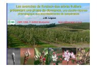
- Page 59 and 60: Les observations phénologiques ali
- Page 61 and 62: Les enregistrements polliniques heb
- Page 63 and 64: II-I. Système d’Observation de l
- Page 65 and 66: Méthodologies • Monitoring rép
- Page 67 and 68: Mesures Pour ce faire une double d
- Page 69 and 70: • analyse des conséquences des d
- Page 71 and 72: Mesures Les mesures systématiques
- Page 73 and 74: ) Mesures Sites d’études : Cette
- Page 75 and 76: (glaciations, tectonique des plaque
- Page 77 and 78: L’objectif de Géosciences Montpe
- Page 79 and 80: III. Formation et intégration univ
- Page 81 and 82: • SEEC et BIMP pour les UE liées
- Page 83 and 84: 2. Formation continue, aide à l’
- Page 85 and 86: IV. Pertinence de l’OSU de Montpe
- Page 87 and 88: labélisées par la Région pour l
- Page 89 and 90: Les recherches fondamentales trouve
- Page 91 and 92: • une commission « Hygiène et S
- Page 93: Il semble toutefois certain que tro
- Page 97: VII-A. Fiches synthétiques des uni
- Page 107 and 108: TS1 : GPS permanent Nom du service
- Page 109 and 110: Nom du service : Responsable : Lieu