Ørtlruntent - State Law Publisher
Ørtlruntent - State Law Publisher
Ørtlruntent - State Law Publisher
Create successful ePaper yourself
Turn your PDF publications into a flip-book with our unique Google optimized e-Paper software.
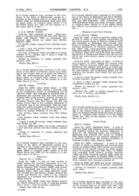
19 May, 1972.] GOVERNMENT GAZETTE, W.A. 1183<br />
IT is hereby declared that, pursuant to the resolution<br />
of the Shire of Kalamunda, passed at a<br />
meeting of the Council held on or about 5th September,<br />
1969, the undermentioned lands have been<br />
set apart, taken, or resumed under section 17 of<br />
the Public Works Act, 1902, for the purpose of a<br />
new road, that is to say:-<br />
Kalamunda.<br />
L. & S. 2269/65 (R.3529).<br />
Road No. 1480 (widening of part). Those portions<br />
of Canning Locations 376, 918, 1674 (Reserve<br />
25222) and Reserve 10601 as delineated and<br />
coloured dark brown on Lands and Surveys<br />
Diagram 74781.<br />
6.7 perches, being resumed from Canning Location<br />
376.<br />
1 acre 1 rood 18.3 perches, being resumed from<br />
Canning Locations 918.<br />
The area of Reserves 10601 and 25222 are hereby<br />
reduced by 8.1 perches and 3 acres 3 roods 20<br />
perches respectively.<br />
(Notice of intention to resume gazetted 21st<br />
January, 1972.)<br />
(Public Plan K19-4.)<br />
IT is hereby declared that, pursuant to the resolution<br />
of the Shire of Kwinana, passed at a meeting<br />
of the Council held on or about 3rd February,<br />
1970, the undermentioned lands have been set<br />
apart, taken, or resumed under section 17 of the<br />
Public Works Act, 1902, for the purpose of a new<br />
road, that is to say :—<br />
Kwinana.<br />
2470/62 (R.4041).<br />
Road No. 14672 (Hope Valley Road). A strip<br />
of land varying in width leaving a surveyed road<br />
at the southeastern corner of Mandogalup Lot 76<br />
(Reserve 18839) and extending as surveyed and as<br />
delineated and coloured mid and dark brown on<br />
Original Plan 11720 generally westerly through the<br />
said lot, Lot 87 (Reserve 24051), Drain Reserve,<br />
Tramway Reserve and Peel Estate Lot 634 and<br />
vacant Crown land to the southern alignment of<br />
a surveyed road at the intersection with the road,<br />
along the eastern boundary of Kwinana Lot 65, including<br />
the intersecting portion of surveyed road<br />
along the western boundary of Lot 634.<br />
26.5 perches, being resumed from Peel Estate<br />
Lot 1150.<br />
28.9 perches, being resumed from Peel Estate<br />
Lot 1302.<br />
7 acres 2 roods 26 perches, being resumed from<br />
Peel Estate Lot 634.<br />
Reserves 18839 and 24051 are hereby reduced by<br />
1 acre and 23.9 perches and 23.4 perches, accordingly.<br />
(Notice of intention to resume gazetted 2nd<br />
July, 1971.)<br />
(Public Plan F219-4.)<br />
IT is hereby declared that, pursuant to the resolution<br />
of the Shire of Manjimup, passed at a<br />
meeting of the Council held on or about 1st June,<br />
1964, the undermentioned lands have been set<br />
apart, taken, or resumed under section 17 of the<br />
Public Works Act, 1902, for the purpose of a new<br />
road, that is to say:-<br />
Manjimup.<br />
5248/53, Vol. 2 (R.3651).<br />
Road No. 14674. A strip of land varying in<br />
width leaving the southern alignment of a surveyed<br />
road along the northwestern boundary of<br />
Nelson Location 7372 (Reserve 16366) and extending<br />
as delineated and coloured dark brown on<br />
Original Plans 10598 and 10599 generally southerly<br />
through the said Reserve, Timber Reserve No.<br />
159/25 and Reserve No. 15974 to the northern<br />
alignment of a surveyed road within the lastmentioned<br />
Reserve.<br />
Reserve Nos. 16366, 15974 and Timber Reserve<br />
No. 159/25 reduced by 3 roods, 2 roods 39.4 perches<br />
and 5 acres 1 rood 16 perches respectively.<br />
(Public Plan 439C/40 E4.)<br />
(2)-97315<br />
IT is hereby declared that, pursuant to the resolution<br />
of the Shires of Mingenew and Three Springs,<br />
passed at a meeting of the Council held on or about<br />
11th and 26th September, 1969, respectively the<br />
undermentioned lands have been set apart, taken,<br />
or resumed under section 17 of the Public Works<br />
Act, 1902, for the purpose of a new road, that is to<br />
say:—<br />
Mingenew and Three Springs.<br />
L & S 2593/53 (R3446).<br />
Road No. 14667. A strip of land five chains wide<br />
varying in width to three chains commencing at<br />
the north-eastern corner of Victoria Location 10107<br />
and extending as delineated and coloured dark<br />
brown on Original Plans 11818, eastwards along the<br />
northern boundaries of Victoria Locations 10478<br />
and 10477 then south-eastwards along the last<br />
mentioned location and then southerly as surveyed<br />
on Original Plans 6321 and 7170 along the western<br />
boundaries of Yandanooka Estate Lots 120, 123 and<br />
127 to the south-western corner of the last mentioned<br />
lot.<br />
Road No. 14667. (Deviation of part). A strip of<br />
land irregular in width leaving the present road<br />
within Victoria Location 10477 and extending as<br />
delineated and coloured dark brown on Lands and<br />
Surveys Diagram 75052 generally southerly through<br />
the said location and Yandanooka Estate Lot 121<br />
rejoining the present road within the last mentioned<br />
lot.<br />
7 acres 0 roods 34 perches, being resumed from<br />
Victoria Location 10477.<br />
8 acres 1 rood 8 perches, being resumed from<br />
Yandanooka Estate Lot 121.<br />
(Notice of intention to resume gazetted 21st<br />
January, 1972.)<br />
(Reserve No. 10876 is hereby reduced by 264<br />
acres and 7 perches, accordingly.)<br />
(Public Plan 123/80 C.3.)<br />
IT is hereby declared that, pursuant to the resolution<br />
of the City of South Perth, passed at a meeting<br />
of the Council held on or about 4th August,<br />
1971, the undermentioned lands have been set apart,<br />
taken, or resumed under section 17 of the Public<br />
Works Act, 1902, for the purpose of a new road,<br />
that is to say:—<br />
3615/71 (R.3652).<br />
South Perth.<br />
Road No. 14675. (Elderfield Road). A strip of<br />
land one chain wide widening at its commencement<br />
and terminus leaving the southern alignment of<br />
Road No. 123 (Manning Road) and extending as<br />
delineated and coloured mid brown on Original<br />
Plan 12013 southerly to the southern alignment of<br />
a surveyed road along the northern boundary of<br />
Canning Location 1279 (Reserve 23967).<br />
Road No. 14675. (extension). A strip of land<br />
varying in width as delineated and coloured dark<br />
brown on Original Plan 12013 leaving the northern<br />
terminus of the present road at the south eastern<br />
corner of Canning Location 1300 (Class "A" 24329)<br />
and extending south easterly through Reserves<br />
23967 and 27449 (Canning Location 1943) along the<br />
north eastern boundary of Reserve 23967 to terminate<br />
within the last mentioned Reserve 6.5 perches<br />
being resumed from Canning Location 37.<br />
Reserves 23967 and 27449 are hereby reduced by<br />
2 roods 16.2 perches and 11.8 perches respectively.<br />
(Notice of intention to resume gazetted 28th<br />
April, 1972.)<br />
(Public Plan F28-4.)<br />
IT is hereby declared that, pursuant to the resolution<br />
of the Shire of Swan, passed at a meeting<br />
of the Council held on or about 2nd July, 1971,<br />
the undermentioned lands have been set apart,


