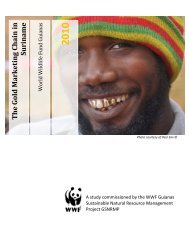
SITUATION ANALYSIS OF THE SMALL-SCALE GOLD ... - WWF
SITUATION ANALYSIS OF THE SMALL-SCALE GOLD ... - WWF
SITUATION ANALYSIS OF THE SMALL-SCALE GOLD ... - WWF

Create successful ePaper yourself
Turn your PDF publications into a flip-book with our unique Google optimized e-Paper software.
NW-SE greenstone belt between the Goliath Hills and the Lawa River, but the E-W<br />
extension is also becoming increasingly important.<br />
Apparently there is a small greenstone formation in West Suriname along the Matapi<br />
Creek and possibly a larger greenstone belt that has a north-south orientation extending<br />
from the Wilhelmina Mountain Range along the Eilerts de Haan and Kayser Mountains<br />
towards the Sipaliwini savanna. An attempt was made by Brazilian miners to mining gold<br />
in the Kutari River west of the Sipaliwini savanna, but the authorities intervened and the<br />
miners left the area.<br />
At the outset, it is useful to recognize the distinction between two basic types of gold<br />
deposits and the kind of mining associated with these deposits.<br />
Primary or lode (vein 8 ) deposits that are primarily exploited by medium- and<br />
large-scale hard rock mining enterprises<br />
Secondary or alluvial (placer 9 ) deposits mostly mined by SSM enterprises or<br />
individuals.<br />
Most of the operations in the Suriname gold mining history worked alluvial deposits,<br />
though gold bearing quarts veins were mined at several locations along the railroad<br />
between kilometers 93 and 133, including the Headley-Reef deposit at km 124.3 (now<br />
beneath the hydro-lake), De Jong Noord, Gros Placer and Mayo Placer (now all part of<br />
the Rosebel Mine). Crushers and ball-mills were used to process the ore.<br />
In the interior of Suriname today, the patterns of placer mining are related to the stream<br />
order in drainage basins. Hydraulic units usually work their way “upstream” in a drainage<br />
basin towards the watershed until they cannot go any further due to the size of rocks and<br />
other barriers in the terrain. Because a significant share of the gold particles is lost in the<br />
tailings, a second and third go-around is often feasible. The drainage basins form natural<br />
demarcations of the zones within which the alluvial mining takes place with hydraulic<br />
units on land and with dredges in the river. In the Chapter VII we will suggest to use<br />
drainage basins as a starting point for zoning of mining areas.<br />
8 Most gold hard rock deposits are formed by a variation of the hydrothermal process, a process that<br />
concentrates metals. It can only be mined profitably where circulating hot acidic fluids have dissolved it<br />
from its source rocks and precipitated it elsewhere in highly concentrated form. If boiling occurs when the<br />
fluids approach the surface, or if there is a reduction in temperature and acidity, the gold is dropped from<br />
solution, often enveloped by masses of white silicon dioxide, known as quarts.<br />
9 Minerals transported downhill from weathered outcrops of primary mineralization zones into stream beds,<br />
river valleys or alluvial plains. Water-borne heavy materials such as gold, platinum, and tine are sorted out<br />
during transport by their density and durability, becoming concentrated as placer deposits wherever flowing<br />
water slows down, for example, in potholes in the stream bed, inside meander bends, downstream from<br />
constrictions in the channel or at the confluence of two or more streams.<br />
13