

Understanding Map Projections
Understanding Map Projections
Understanding Map Projections

Create successful ePaper yourself
Turn your PDF publications into a flip-book with our unique Google optimized e-Paper software.
PROJECTED COORDINATE SYSTEMS<br />
A projected coordinate system is defined on a flat,<br />
two-dimensional surface. Unlike a geographic<br />
coordinate system, a projected coordinate system has<br />
constant lengths, angles, and areas across the two<br />
dimensions. A projected coordinate system is always<br />
based on a geographic coordinate system that is<br />
based on a sphere or spheroid.<br />
In a projected coordinate system, locations are<br />
identified by x,y coordinates on a grid, with the<br />
origin at the center of the grid. Each position has<br />
two values that reference it to that central location.<br />
One specifies its horizontal position and the other its<br />
vertical position. The two values are called the<br />
x-coordinate and y-coordinate. Using this notation,<br />
the coordinates at the origin are x = 0 and y = 0.<br />
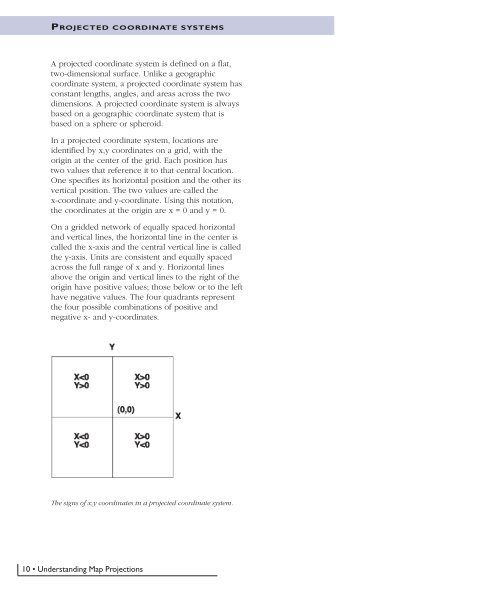
On a gridded network of equally spaced horizontal<br />
and vertical lines, the horizontal line in the center is<br />
called the x-axis and the central vertical line is called<br />
the y-axis. Units are consistent and equally spaced<br />
across the full range of x and y. Horizontal lines<br />
above the origin and vertical lines to the right of the<br />
origin have positive values; those below or to the left<br />
have negative values. The four quadrants represent<br />
the four possible combinations of positive and<br />
negative x- and y-coordinates.<br />
The signs of x,y coordinates in a projected coordinate system.<br />
10 • <strong>Understanding</strong> <strong>Map</strong> <strong>Projections</strong>


