

Understanding Map Projections
Understanding Map Projections
Understanding Map Projections

Create successful ePaper yourself
Turn your PDF publications into a flip-book with our unique Google optimized e-Paper software.
NEW ZEALAND NATIONAL GRID<br />
Area<br />
Distortion is less than 0.04 percent for New Zealand.<br />
Direction<br />
Minimal distortion within New Zealand.<br />
Distance<br />
Scale is within 0.02 percent of true scale for New<br />
Zealand.<br />
LIMITATIONS<br />
Not useful for areas outside New Zealand.<br />
USES AND APPLICATIONS<br />
Used for large-scale maps of New Zealand.<br />
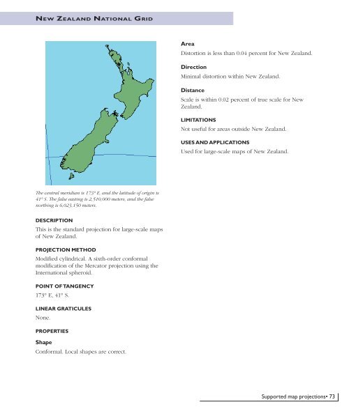
The central meridian is 173° E, and the latitude of origin is<br />
41° S. The false easting is 2,510,000 meters, and the false<br />
northing is 6,023,150 meters.<br />
DESCRIPTION<br />
This is the standard projection for large-scale maps<br />
of New Zealand.<br />
PROJECTION METHOD<br />
Modified cylindrical. A sixth-order conformal<br />
modification of the Mercator projection using the<br />
International spheroid.<br />
POINT OF TANGENCY<br />
173° E, 41° S.<br />
LINEAR GRATICULES<br />
None.<br />
PROPERTIES<br />
Shape<br />
Conformal. Local shapes are correct.<br />
Supported map projections• 73


