

Understanding Map Projections
Understanding Map Projections
Understanding Map Projections

You also want an ePaper? Increase the reach of your titles
YUMPU automatically turns print PDFs into web optimized ePapers that Google loves.
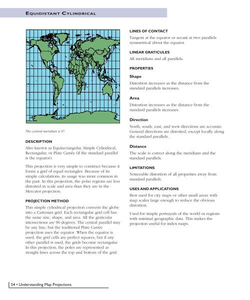
EQUIDISTANT CYLINDRICAL<br />
LINES OF CONTACT<br />
Tangent at the equator or secant at two parallels<br />
symmetrical about the equator.<br />
LINEAR GRATICULES<br />
All meridians and all parallels.<br />
PROPERTIES<br />
Shape<br />
Distortion increases as the distance from the<br />
standard parallels increases.<br />
Area<br />
Distortion increases as the distance from the<br />
standard parallels increases.<br />
The central meridian is 0°.<br />
DESCRIPTION<br />
Also known as Equirectangular, Simple Cylindrical,<br />
Rectangular, or Plate Carrée (if the standard parallel<br />
is the equator).<br />
This projection is very simple to construct because it<br />
forms a grid of equal rectangles. Because of its<br />
simple calculations, its usage was more common in<br />
the past. In this projection, the polar regions are less<br />
distorted in scale and area than they are in the<br />
Mercator projection.<br />
PROJECTION METHOD<br />
This simple cylindrical projection converts the globe<br />
into a Cartesian grid. Each rectangular grid cell has<br />
the same size, shape, and area. All the graticular<br />
intersections are 90 degrees. The central parallel may<br />
be any line, but the traditional Plate Carrée<br />
projection uses the equator. When the equator is<br />
used, the grid cells are perfect squares, but if any<br />
other parallel is used, the grids become rectangular.<br />
In this projection, the poles are represented as<br />
straight lines across the top and bottom of the grid.<br />
Direction<br />
North, south, east, and west directions are accurate.<br />
General directions are distorted, except locally along<br />
the standard parallels.<br />
Distance<br />
The scale is correct along the meridians and the<br />
standard parallels.<br />
LIMITATIONS<br />
Noticeable distortion of all properties away from<br />
standard parallels.<br />
USES AND APPLICATIONS<br />
Best used for city maps or other small areas with<br />
map scales large enough to reduce the obvious<br />
distortion.<br />
Used for simple portrayals of the world or regions<br />
with minimal geographic data. This makes the<br />
projection useful for index maps.<br />
54 • <strong>Understanding</strong> <strong>Map</strong> <strong>Projections</strong>


