

Understanding Map Projections
Understanding Map Projections
Understanding Map Projections

Create successful ePaper yourself
Turn your PDF publications into a flip-book with our unique Google optimized e-Paper software.
GEOGRAPHIC TRANSFORMATION METHODS<br />
Moving your data between coordinate systems<br />
sometimes includes transforming between the<br />
geographic coordinate systems.<br />
These include the Geocentric Translation,<br />
Molodensky, and Coordinate Frame methods.<br />
Other methods such as NADCON and NTv2 use a<br />
grid of differences and convert the longitude–latitude<br />
values directly.<br />
Because the geographic coordinate systems contain<br />
datums that are based on spheroids, a geographic<br />
transformation also changes the underlying spheroid.<br />
There are several methods, which have different<br />
levels of accuracy and ranges, for transforming<br />
between datums. The accuracy of a particular<br />
transformation can range from centimeters to meters<br />
depending on the method and the quality and<br />
number of control points available to define the<br />
transformation parameters.<br />
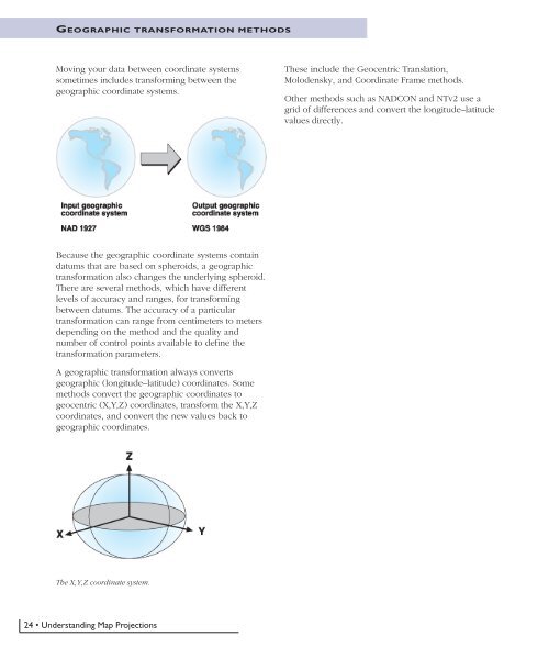
A geographic transformation always converts<br />
geographic (longitude–latitude) coordinates. Some<br />
methods convert the geographic coordinates to<br />
geocentric (X,Y,Z) coordinates, transform the X,Y,Z<br />
coordinates, and convert the new values back to<br />
geographic coordinates.<br />
The X,Y,Z coordinate system.<br />
24 • <strong>Understanding</strong> <strong>Map</strong> <strong>Projections</strong>


