Wednesday, December 05, 2012 - Regular Planning ... - Polk County
Wednesday, December 05, 2012 - Regular Planning ... - Polk County
Wednesday, December 05, 2012 - Regular Planning ... - Polk County

Create successful ePaper yourself
Turn your PDF publications into a flip-book with our unique Google optimized e-Paper software.
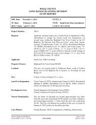
Proposed Site – 2.35<br />
acres<br />
(RMX)<br />
Permitted Density/<br />
Maximum number of Lots<br />
Estimated Impact Analysis (Residential / Commercial)<br />
(Existing Land Use<br />
Designation)<br />
(Maximum Density /<br />
usage)<br />
(Proposed Site Plan)<br />
1 single-family<br />
dwelling unit<br />
15 single-family<br />
dwelling units by<br />
achieving the<br />
maximum density for a<br />
Planned Development<br />
religious institution<br />
seating for<br />
approximately 228<br />
individuals<br />
Average Annual Daily<br />
9 135 64<br />
Trips (AADT)<br />
PM Peak Hour Trips 1 15 4<br />
Source: <strong>Polk</strong> <strong>County</strong> Concurrency Manual and Institute of Traffic Engineers (ITE)<br />
Environmental Conditions:<br />
A. Surface Water:<br />
The nearest water body is Lake Locke approximately ½ mile to the southwest. There are no existing<br />
water bodies on the site or flood plains on the subject site. There is a small wetland on the eastern<br />
most portion of the subject site which will not be impacted as part of this expansion; therefore, it<br />
does not appear that this facility will pose any adverse impacts to any water bodies.<br />
B. Wetlands/Floodplains:<br />
There are no floodplains on the subject site. There is a small wetland on the eastern property<br />
boundary which will not be impacted as a result of this development.<br />
C. Wells (Public/Private)<br />
According to the applicant, there is a potable well on the site.<br />
D. Archeological Resources:<br />
According to the State Office of Historic Preservation, this site is not located on or near any known<br />
archeological resources.<br />
E. Airports:<br />
The subject site is not within an airport buffer zone.<br />
F. Soils:<br />
Soil Name<br />
Small<br />
Commercial<br />
Buildings<br />
Septic Tank<br />
Limitations<br />
Tavares Fine Sand/0 to 5 percent slopes Moderate: wetness Severe: wetness, poor<br />
filter<br />
Approximate<br />
Percentage of Site<br />
100%<br />
DRC Findings/Recommendation Page 6 of 11<br />
Level 3/BGD 11/20/<strong>2012</strong> 2:27 PM CU 12-19 <strong>December</strong> 5, <strong>2012</strong>