

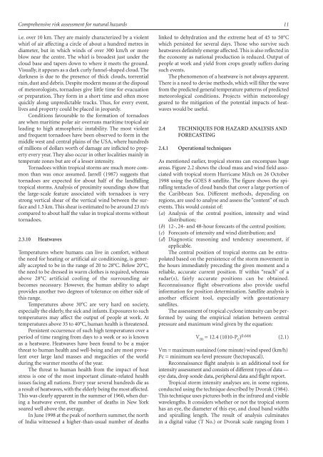
Comprehensive Risk Assessment for Natural Hazards - Planat
Comprehensive Risk Assessment for Natural Hazards - Planat
Comprehensive Risk Assessment for Natural Hazards - Planat

Create successful ePaper yourself
Turn your PDF publications into a flip-book with our unique Google optimized e-Paper software.
<strong>Comprehensive</strong> risk assessment <strong>for</strong> natural hazards<br />
i.e. over 10 km. They are mainly characterized by a violent<br />
whirl of air affecting a circle of about a hundred metres in<br />
diameter, but in which winds of over 300 km/h or more<br />
blow near the centre. The whirl is broadest just under the<br />
cloud base and tapers down to where it meets the ground.<br />
Visually, it appears as a dark curly funnel-shaped cloud. The<br />
darkness is due to the presence of thick clouds, torrential<br />
rain, dust and debris. Despite modern means at the disposal<br />
of meteorologists, tornadoes give little time <strong>for</strong> evacuation<br />
or preparation. They <strong>for</strong>m in a short time and often move<br />
quickly along unpredictable tracks. Thus, <strong>for</strong> every event,<br />
lives and property could be placed in jeopardy.<br />
Conditions favourable to the <strong>for</strong>mation of tornadoes<br />
are when maritime polar air overruns maritime tropical air<br />
leading to high atmospheric instability. The most violent<br />
and frequent tornadoes have been observed to <strong>for</strong>m in the<br />
middle west and central plains of the USA, where hundreds<br />
of millions of dollars worth of damage are inflicted to property<br />
every year. They also occur in other localities mainly in<br />
temperate zones but are of a lesser intensity.<br />
Tornadoes within tropical storms are much more common<br />
than was once assumed. Jarrell (1987) suggests that<br />
tornadoes are expected <strong>for</strong> about half of the landfalling<br />
tropical storms. Analysis of proximity soundings show that<br />
the large-scale feature associated with tornadoes is very<br />
strong vertical shear of the vertical wind between the surface<br />
and 1.5 km. This shear is estimated to be around 23 m/s<br />
compared to about half the value in tropical storms without<br />
tornadoes.<br />
2.3.10 Heatwaves<br />
Temperatures where humans can live in com<strong>for</strong>t, without<br />
the need <strong>for</strong> heating or artificial air conditioning, is generally<br />
accepted to be in the range of 20 to 28°C. Below 20°C,<br />
the need to be dressed in warm clothes is required, whereas<br />
above 28°C artificial cooling of the surrounding air<br />
becomes necessary. However, the human ability to adapt<br />
provides another two degrees of tolerance on either side of<br />
this range.<br />
Temperatures above 30°C are very hard on society,<br />
especially the elderly, the sick and infants. Exposures to such<br />
temperatures may affect the output of people at work. At<br />
temperatures above 35 to 40°C, human health is threatened.<br />
Persistent occurrence of such high temperatures over a<br />
period of time ranging from days to a week or so is known<br />
as a heatwave. Heatwaves have been found to be a major<br />
threat to human health and well-being and are most prevalent<br />
over large land masses and megacities of the world<br />
during the warmer months of the year.<br />
The threat to human health from the impact of heat<br />
stress is one of the most important climate-related health<br />
issues facing all nations. Every year several hundreds die as<br />
a result of heatwaves, with the elderly being the most affected.<br />
This was clearly apparent in the summer of 1960, when during<br />
a heatwave event, the number of deaths in New York<br />
soared well above the average.<br />
In June 1998 at the peak of northern summer, the north<br />
of India witnessed a higher-than-usual number of deaths<br />
linked to dehydration and the extreme heat of 45 to 50°C<br />
which persisted <strong>for</strong> several days. Those who survive such<br />
heatwaves definitely emerge affected. This is also reflected in<br />
the economy as national production is reduced. Output of<br />
people at work and yield from crops greatly suffers during<br />
such events.<br />
The phenomenon of a heatwave is not always apparent.<br />
There is a need to devise methods, which will filter the wave<br />
from the predicted general temperature patterns of predicted<br />
meteorological conditions. Projects within meteorology<br />
geared to the mitigation of the potential impacts of heatwaves<br />
would be useful.<br />
2.4 TECHNIQUES FOR HAZARD ANALYSIS AND<br />
FORECASTING<br />
2.4.1 Operational techniques<br />
As mentioned earlier, tropical storms can encompass huge<br />
areas. Figure 2.2 shows the cloud mass and wind field associated<br />
with tropical storm Hurricane Mitch on 26 October<br />
1998 using the GOES 8 satellite. The figure shows the spiralling<br />
tentacles of cloud bands that cover a large portion of<br />
the Caribbean Sea. Different methods, depending on<br />
regions, are used to analyse and assess the “content” of such<br />
events. This would consist of:<br />
(a) Analysis of the central position, intensity and wind<br />
distribution;<br />
(b) 12-, 24- and 48-hour <strong>for</strong>ecasts of the central position;<br />
(c) Forecasts of intensity and wind distribution; and<br />
(d) Diagnostic reasoning and tendency assessment, if<br />
applicable.<br />
The central position of tropical storms can be extrapolated<br />
based on the persistence of the storm movement in<br />
the hours immediately preceding the given moment and a<br />
reliable,accurate current position.Ifwithin “reach”ofa<br />
radar(s), fairly accurate positions can be obtained.<br />
Reconnaissance flight observations also provide useful<br />
in<strong>for</strong>mation <strong>for</strong> position determination. Satellite analysis is<br />
another efficient tool, especially with geostationary<br />
satellites.<br />
The assessment of tropical cyclone intensity can be per<strong>for</strong>med<br />
by using the empirical relation between central<br />
pressure and maximum wind given by the equation:<br />
V m = 12.4 (1010-P c ) 0.644 (2.1)<br />
Vm = maximum sustained (one minute) wind speed (km/h)<br />
Pc = minimum sea-level pressure (hectopascal).<br />
Reconnaissance flight analysis is an additional tool <strong>for</strong><br />
intensity assessment and consists of different types of data —<br />
eye data, drop sonde data, peripheral data and flight report.<br />
Tropical storm intensity analyses are, in some regions,<br />
conducted using the technique described by Dvorak (1984).<br />
This technique uses pictures both in the infrared and visible<br />
wavelengths. It considers whether or not the tropical storm<br />
has an eye, the diameter of this eye, and cloud band widths<br />
and spiralling length. The result of analysis culminates<br />
in a digital value (T No.) or Dvorak scale ranging from 1<br />
11


