

Comprehensive Risk Assessment for Natural Hazards - Planat
Comprehensive Risk Assessment for Natural Hazards - Planat
Comprehensive Risk Assessment for Natural Hazards - Planat

Create successful ePaper yourself
Turn your PDF publications into a flip-book with our unique Google optimized e-Paper software.
<strong>Comprehensive</strong> risk assessment <strong>for</strong> natural hazards<br />
19<br />
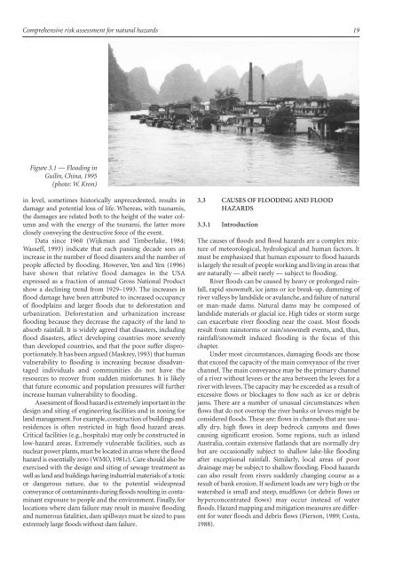
Figure 3.1 — Flooding in<br />
Guilin, China, 1995<br />
(photo: W. Kron)<br />
in level, sometimes historically unprecedented, results in<br />
damage and potential loss of life. Whereas, with tsunamis,<br />
the damages are related both to the height of the water column<br />
and with the energy of the tsunami, the latter more<br />
closely conveying the destructive <strong>for</strong>ce of the event.<br />
Data since 1960 (Wijkman and Timberlake, 1984;<br />
Wasseff, 1993) indicate that each passing decade sees an<br />
increase in the number of flood disasters and the number of<br />
people affected by flooding. However, Yen and Yen (1996)<br />
have shown that relative flood damages in the USA<br />
expressed as a fraction of annual Gross National Product<br />
show a declining trend from 1929–1993. The increases in<br />
flood damage have been attributed to increased occupancy<br />
of floodplains and larger floods due to de<strong>for</strong>estation and<br />
urbanization. De<strong>for</strong>estation and urbanization increase<br />
flooding because they decrease the capacity of the land to<br />
absorb rainfall. It is widely agreed that disasters, including<br />
flood disasters, affect developing countries more severely<br />
than developed countries, and that the poor suffer disproportionately.<br />
It has been argued (Maskrey, 1993) that human<br />
vulnerability to flooding is increasing because disadvantaged<br />
individuals and communities do not have the<br />
resources to recover from sudden mis<strong>for</strong>tunes. It is likely<br />
that future economic and population pressures will further<br />
increase human vulnerability to flooding.<br />
<strong>Assessment</strong> of flood hazard is extremely important in the<br />
design and siting of engineering facilities and in zoning <strong>for</strong><br />
land management. For example, construction of buildings and<br />
residences is often restricted in high flood hazard areas.<br />
Critical facilities (e.g., hospitals) may only be constructed in<br />
low-hazard areas. Extremely vulnerable facilities, such as<br />
nuclear power plants, must be located in areas where the flood<br />
hazard is essentially zero (WMO, 1981c). Care should also be<br />
exercised with the design and siting of sewage treatment as<br />
well as land and buildings having industrial materials of a toxic<br />
or dangerous nature, due to the potential widespread<br />
conveyance of contaminants during floods resulting in contaminant<br />
exposure to people and the environment. Finally, <strong>for</strong><br />
locations where dam failure may result in massive flooding<br />
and numerous fatalities, dam spillways must be sized to pass<br />
extremely large floods without dam failure.<br />
3.3 CAUSES OF FLOODING AND FLOOD<br />
HAZARDS<br />
3.3.1 Introduction<br />
The causes of floods and flood hazards are a complex mixture<br />
of meteorological, hydrological and human factors. It<br />
must be emphasized that human exposure to flood hazards<br />
is largely the result of people working and living in areas that<br />
are naturally — albeit rarely — subject to flooding.<br />
River floods can be caused by heavy or prolonged rainfall,rapid<br />
snowmelt,ice jams or ice break-up,damming of<br />
river valleys by landslide or avalanche, and failure of natural<br />
or man-made dams. <strong>Natural</strong> dams may be composed of<br />
landslide materials or glacial ice. High tides or storm surge<br />
can exacerbate river flooding near the coast. Most floods<br />
result from rainstorms or rain/snowmelt events, and, thus,<br />
rainfall/snowmelt induced flooding is the focus of this<br />
chapter.<br />
Under most circumstances, damaging floods are those<br />
that exceed the capacity of the main conveyance of the river<br />
channel. The main conveyance may be the primary channel<br />
of a river without levees or the area between the levees <strong>for</strong> a<br />
river with levees. The capacity may be exceeded as a result of<br />
excessive flows or blockages to flow such as ice or debris<br />
jams. There are a number of unusual circumstances when<br />
flows that do not overtop the river banks or levees might be<br />
considered floods. These are: flows in channels that are usually<br />
dry, high flows in deep bedrock canyons and flows<br />
causing significant erosion. Some regions, such as inland<br />
Australia, contain extensive flatlands that are normally dry<br />
but are occasionally subject to shallow lake-like flooding<br />
after exceptional rainfall. Similarly, local areas of poor<br />
drainage may be subject to shallow flooding. Flood hazards<br />
can also result from rivers suddenly changing course as a<br />
result of bank erosion. If sediment loads are very high or the<br />
watershed is small and steep, mudflows (or debris flows or<br />
hyperconcentrated flows) may occur instead of water<br />
floods. Hazard mapping and mitigation measures are different<br />
<strong>for</strong> water floods and debris flows (Pierson, 1989; Costa,<br />
1988).


