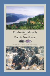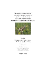
Outline of Quino Recovery Plan - The Xerces Society
Outline of Quino Recovery Plan - The Xerces Society
Outline of Quino Recovery Plan - The Xerces Society

Create successful ePaper yourself
Turn your PDF publications into a flip-book with our unique Google optimized e-Paper software.
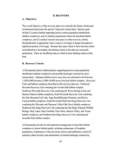
A. Objectives<br />
II. RECOVERY<br />
<strong>The</strong> overall objective <strong>of</strong> this recovery plan is to reclassify the <strong>Quino</strong> checkerspot<br />
to threatened and ensure the species’ long-term conservation. Interim goals<br />
include (1) protect habitat supporting known current population distributions<br />
(habitat complexes), and (2) stabilize populations within the described habitat<br />
complexes, and (3) conduct research necessary to refine recovery criteria.<br />
Reclassification is appropriate when a taxon is no longer in danger throughout a<br />
significant portion <strong>of</strong> its range. Because data upon which to base decisions about<br />
reclassification is incomplete, downlisting criteria in this plan are necessarily<br />
preliminary. <strong>The</strong>re are insufficient data on which to base delisting criteria at this<br />
time.<br />
B. <strong>Recovery</strong> Criteria<br />
1) Permanently protect habitat patches supporting known extant population<br />
distributions (habitat complexes) and possible landscape connectivity areas<br />
among them. Adequate habitat reserve area sizes are estimated to be between<br />
1,200-4,000 hectares (3,000-10,000 acres) total per habitat complex. <strong>Recovery</strong><br />
Units and habitat complexes described in this recovery plan are: Northwest<br />
Riverside <strong>Recovery</strong> Unit containing the Gavilan Hills habitat complex,<br />
Southwest Riverside <strong>Recovery</strong> Unit containing the Warm Springs Creek and<br />
Skinner/Johnson habitat complexes, South Riverside <strong>Recovery</strong> Unit containing<br />
the Oak Mountain/Vail Lake, Sage Road/Billygoat Mountain, and Brown<br />
Canyon habitat complexes, South Riverside/North San Diego <strong>Recovery</strong> Unit<br />
containing the Silverado and Dameron Valley/Oak Grove habitat complexes,<br />
Southwest San Diego <strong>Recovery</strong> Unit containing the San Diego National Wildlife<br />
Refuge, Otay Lakes, Otay Foothills, Otay Mesa, Marron Valley, and Tecate<br />
habitat complexes, and Southeast San Diego <strong>Recovery</strong> Unit containing the<br />
Jacumba Peak habitat complex.<br />
2) Permanently provide for and implement management <strong>of</strong> described habitat<br />
complexes to restore habitat quality, including maintenance <strong>of</strong> hostplant<br />
populations, maintenance <strong>of</strong> diverse nectar sources and pollinators, control <strong>of</strong><br />
nonnative plant invasion, and maintenance <strong>of</strong> internal landscape connectivity.<br />
69