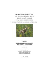
Outline of Quino Recovery Plan - The Xerces Society
Outline of Quino Recovery Plan - The Xerces Society
Outline of Quino Recovery Plan - The Xerces Society

Create successful ePaper yourself
Turn your PDF publications into a flip-book with our unique Google optimized e-Paper software.
4.1. Develop and implement the proposed Vista Murrieta High School project<br />
(Helix 2000), in the Murrieta area. Restore and maintain occupied habitat<br />
adjacent to the high school, augment and monitor populations.<br />
4.2. Initiate a pilot program similar to that proposed for Vista Murrieta High<br />
School in the Otay area, associated with the San Diego National Wildlife<br />
Refuge complex.<br />
4.3. Initiate further cooperative outreach efforts with local nongovernmental<br />
organizations, educational institutions, and local museums.<br />
5. Conduct biological research needed to refine recovery criteria and guide<br />
conservation efforts.<br />
5.1. Conduct preliminary modeling <strong>of</strong> metapopulation dynamics for the<br />
Southwest Riverside and Southwest San Diego <strong>Recovery</strong> Unit habitat<br />
complexes.<br />
5.2. Investigate the function <strong>of</strong> hilltops as a resource for <strong>Quino</strong> checkerspot<br />
populations.<br />
5.3. Investigate the contribution <strong>of</strong> multiple-year diapause to metapopulation<br />
stability.<br />
5.4. Monitor populations for further evidence <strong>of</strong> climate-driven range shifts.<br />
5.5. Determine the effect <strong>of</strong> elevated atmospheric carbon dioxide and nitrogen<br />
fertilization on the <strong>Quino</strong> checkerspot and its hostplant.<br />
5.6. Survey areas between and around habitat complexes to determine where<br />
there is intervening and/or additional landscape connectivity (a possible<br />
greater metapopulation distribution). Surveys should be conducted in all<br />
areas within 7.5 kilometers (4.7 miles) <strong>of</strong> recent butterfly observations<br />
because: 1) <strong>The</strong> existence <strong>of</strong> undocumented occupied habitat patches is<br />
highly probable, and 2) current population distributions are greatly reduced<br />
relative to historic densities and distributions, and occupied habitat patches<br />
will be sources <strong>of</strong> former and future population expansions needed for<br />
metapopulation stability (see metapopulation footprint model estimates in<br />
Harrison 1989).<br />
5.7. Map habitat complex attributes. Areas that need to be mapped are:<br />
habitat patches occupied by larvae, suitable or restorable habitat patches not<br />
currently occupied by larvae, habitat linkage areas needed for landscape<br />
connectivity, and buffer areas needed to insulate habitat patches from impacts<br />
<strong>of</strong> nearby development. Information gathered concurrently during surveys<br />
75