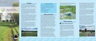
5: victorian villages - The Royal Borough of Windsor and Maidenhead
5: victorian villages - The Royal Borough of Windsor and Maidenhead
5: victorian villages - The Royal Borough of Windsor and Maidenhead

You also want an ePaper? Increase the reach of your titles
YUMPU automatically turns print PDFs into web optimized ePapers that Google loves.
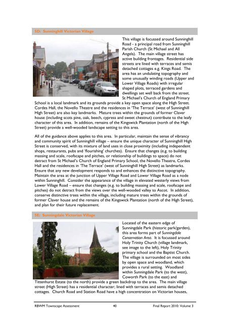
5D: Sunninghill Victorian Village<br />
This village is focussed around Sunninghill<br />
Road - a principal road from Sunninghill<br />
Parish Church (St Michael <strong>and</strong> All<br />
Angels). <strong>The</strong> main village street has<br />
active building frontages. Residential side<br />
streets are lined with terraces <strong>and</strong> semis<br />
detached cottages e.g. Kings Road. <strong>The</strong><br />
area has an undulating topography <strong>and</strong><br />
some unusually winding roads (Upper <strong>and</strong><br />
Lower Village Roads) with irregular<br />
shaped plots, terraced gardens <strong>and</strong><br />
dwellings set well back from the street.<br />
St Michael’s Church <strong>of</strong> Engl<strong>and</strong> Primary<br />
School is a local l<strong>and</strong>mark <strong>and</strong> its grounds provide a key open space along the High Street.<br />
Cordes Hall, the Novello <strong>The</strong>atre <strong>and</strong> the residences in ‘<strong>The</strong> Terrace’ (west <strong>of</strong> Sunninghill<br />
High Street) are also key l<strong>and</strong>marks. Mature trees within the grounds <strong>of</strong> former Claver<br />
house (including scots pine, oak, beech, cypress <strong>and</strong> sweet chestnut) contribute to the leafy<br />
character <strong>of</strong> this area. In addition, remains <strong>of</strong> the Kingswick Plantation (north <strong>of</strong> the High<br />
Street) provide a well-wooded l<strong>and</strong>scape setting to this area.<br />
All <strong>of</strong> the guidance above applies to this area. In particular, maintain the sense <strong>of</strong> vibrancy<br />
<strong>and</strong> community spirit <strong>of</strong> Sunninghill village – ensure the unique character <strong>of</strong> Sunninghill High<br />
Street is conserved, with its mixture <strong>of</strong> l<strong>and</strong> uses in close proximity (including independent<br />
shops, restaurants, pubs <strong>and</strong> ‘flourishing’ churches). Ensure that changes (e.g. to building<br />
massing <strong>and</strong> scale, ro<strong>of</strong>scape <strong>and</strong> pitches, or relationship <strong>of</strong> buildings to space) do not<br />
detract from St Michael’s Church <strong>of</strong> Engl<strong>and</strong> Primary School, the Novello <strong>The</strong>atre, Cordes<br />
Hall <strong>and</strong> the residences in ‘<strong>The</strong> Terrace’ (west <strong>of</strong> Sunninghill High Street) as l<strong>and</strong>marks.<br />
Ensure that any new development responds to <strong>and</strong> enhances the distinctive topography.<br />
Maintain the area at the junction <strong>of</strong> Upper Village Road <strong>and</strong> Lower Village Road as a node<br />
within Sunninghill. Consider the appearance <strong>of</strong> the village in elevated westerly views from<br />
Lower Village Road – ensure that changes (e.g. to building massing <strong>and</strong> scale, ro<strong>of</strong>scape <strong>and</strong><br />
pitches) do not detract from the views over the well-wooded valley to Ascot. In addition,<br />
conserve distinctive trees within the village, including mature trees within the grounds <strong>of</strong><br />
former Claver house <strong>and</strong> the remains <strong>of</strong> the Kingswick Plantation (north <strong>of</strong> the High Street),<br />
<strong>and</strong> plan for their future replacement.<br />
5E: Sunningdale Victorian Village<br />
Located <strong>of</strong> the eastern edge <strong>of</strong><br />
Sunningdale Park (historic park/garden),<br />
this area forms part <strong>of</strong> Sunningdale<br />
Conservation Area. It is focussed around<br />
Holy Trinity Church (village l<strong>and</strong>mark,<br />
see image to the left), Holy Trinity<br />
primary school <strong>and</strong> the Baptist Church.<br />
<strong>The</strong> village is surrounded on most sides<br />
by open space <strong>and</strong> woodl<strong>and</strong>, which<br />
provides a rural setting. Woodl<strong>and</strong><br />
within Sunningdale Park (to the west),<br />
Coworth Park (to the east) <strong>and</strong><br />
Tittenhurst Estate (to the north) provide a green backdrop to the area. <strong>The</strong> main village<br />
street (High Street) has a residential character; lined with terraces <strong>and</strong> semis detached<br />
cottages. Church Road <strong>and</strong> Station Road have a high concentration on Victorian houses,<br />
RBWM Townscape Assessment 40 Final Report 2010: Volume 3