Part I
Part I
Part I

You also want an ePaper? Increase the reach of your titles
YUMPU automatically turns print PDFs into web optimized ePapers that Google loves.
Draft Black Sea Regional Transmission Project ESIA<br />
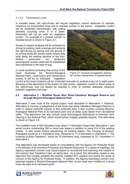
2.1.3.2 Transmission Lines<br />
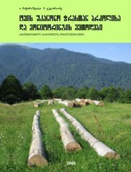
In forested areas, the right-of-way will require vegetation control measures to maintain<br />
clearance for transmission lines and to maintain access to the towers. Vegetation control<br />
will be conducted mechanically, with cutting<br />
activities occurring every 6 to 8 years.<br />
Herbicides will not be used for vegetation<br />
control. An example of a cleared corridor in<br />
forested terrain is shown in Figure 2-7.<br />
Access to towers locations will be achieved by<br />
driving to existing road crossings and entering<br />
the right-of-way by driving over the ground or<br />
by driving along dirt access roads (where they<br />
exist along the existing sections of the line).<br />
Neither permanent nor temporary<br />
paved/gravel access roads will be established<br />
and maintained in the right-of-way.<br />
In some locations (including that portion of the<br />
route traversing the Borjomi-Karagauli<br />
National Park), construction and maintenance<br />
access is will be by helicopter. Vegetation<br />
Figure 2-7. Example of vegetation clearing<br />
for corridor maintenance in forested terrain<br />
control at the tower locations will be conducted manually by workers every six to eight years.<br />
Because of the placement of the towers on high points, vegetation control in these areas of<br />
the right-of-way may not always be required in order to maintain adequate clearance<br />
between vegetation and lines.<br />
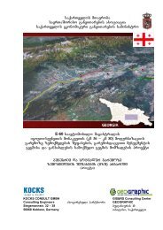
2.2 Alternative 2 – Modified Route Near Ktsia-Tabatskuri Managed Reserve and<br />
through Borjomi-Kharagauli National Park<br />
Alternative 2 uses most of the original project route described in Alternative 1. However,<br />
Alternative 2 involves a realignment of the route near Ktsia-Tabatskuri Managed Reserve in<br />
order to reduce potential impacts to that protected area. It also involves crossing Borjomi-<br />
Kharagauli National Park at its narrowest point and at areas quite distant from recreational<br />
traffic. This alternative can also include some technological alternatives to minimize landclearing<br />
in the National Park, which would further mitigate potential impacts. This alternative<br />
is shown in Figure 2-8.<br />
The modified route is 294 kilometers long, about 11 kilometers longer than Alternative 1, and<br />
would involve constructing 350 or more new towers in addition to using 514 of the existing<br />
towers. It also would involve abandoning 40 existing towers. The crossing of Borjomi-<br />
Kharagauli would be 4.7 kilometers long, compared to 11.5 kilometers in Alternative 1. The<br />
crossing of Ktsia-Tabatskuri would be 10 kilometers long, compared to 12.1 kilometers in<br />
Alternative 1.<br />
This alternative was developed based on consultations with the Agency for Protected Areas<br />
in the Ministry of Environment Protection and Natural Resources In a series of meetings, the<br />
Agency expressed concern over visual impacts to recreational bird-watching and impacts to<br />
bird species near Tabatskuri Lake, an alpine lake. As a result, this alternative creates a new<br />
alignment that roughly parallels the recently installed BTC pipeline and avoids the areas of<br />
concern to the Agency for Protected Areas. In addition, the Agency expressed concern over<br />
potential impacts in Borjomi-Kharagauli National Park, so the route was modified so it would<br />
cross the park at its narrowest point.<br />
20