Part I
Part I
Part I

Create successful ePaper yourself
Turn your PDF publications into a flip-book with our unique Google optimized e-Paper software.
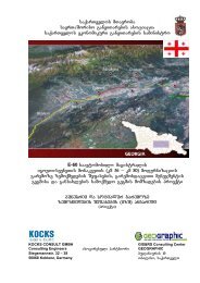
Draft Black Sea Regional Transmission Project ESIA<br />
Quaternary sediments are represented mostly by boulder-pebbles and are characterized by<br />
high water content. The Uraveli River basin is formed mostly with recent Quaternary and<br />
Eocene age so-called Kisatibi (Goderdzi) layers and lava and tuff formations. These<br />
sediments are presented by (form bottom to top):<br />
<br />
<br />
<br />
<br />
<br />
Psammite tuffs with insertions of red conglomerate lenses.<br />
Andesite-basalt and basalt layers.<br />
Conglomerates, andesite-dacite tuffs.<br />
Thick layers of tuff-breccias, tuff-conglomerates and tuff ashes.<br />
Thick layers of andesites and andesite-dacites.<br />
4.1.4.8 Baghdati district<br />
Stratigraphy. The geological structure of this area is represented by meso-Cainozoic and<br />
Quaternary thick terrigenous, carbonaceous and effusive formations. The Quaternary and<br />
Cainozoic sediments have the widest distribution. Lower Cretaceous (K 1 ) rocks have<br />
transgressive overlapping over the Jurassic sediments and they are represented with<br />
dolomites, limestones, marls, and clays over 600 meters deep. Upper Cretaceous (K 2 )<br />
sediments outcrop in foothills and mountainside banks of Adjara-Trialeti ridge. They are<br />
represented with limestones, guffogenes and others to a depth of 500-600 meters.<br />
Paleocene (P) system is represented with Paleocene-Lower Miocene (P 1 -P 2 ), Mid Eocene<br />
(P 2 1 ), Upper Eocene (P 2 3 ) and Oligocene-Lower Miocene (P 3 -N 1 1 ) rocks. First three stages<br />
are represented with Clayey Limestones, Marls, Tuffs and Clays in general, with overall<br />
depths about 1500 m; and the Oligocene-Lower Miocene – with non-carbonaceous layered<br />
Clays with depths of 600 meters.<br />
The Neogene (N) system is represented with all stages of Eocene and partly with Pliocene.<br />
These layers are formed with compact sandstones, calcareous sandstones, clays and<br />
limestones with an overall depth of 1000 meters.<br />
Quaternary sediments (Q) have a wide distribution in the region and represent continental<br />
formations. They are described with facial changes and miscellaneous geological-structural<br />
and geomorphologic features.<br />
The depth of Quaternary sediments decreases from west to east and ranges from several<br />
meters to 300 meters. Recent sediments are divided into River, Alluvial, Prolluvial and<br />
Delluvial formations by genetic features.<br />
Recent Quaternary sediments (aQ IV ) are distributed in river valleys and represented with<br />
riverbed and floodplain facieses; their depth is changing within 2-20 m limits. These<br />
decrease from east to west. Delluvial-Prolluvial sediments (d-aQ IV ) are distributed at the<br />
bottoms of banks and represented with pebbles-detritus clays and clayey soil. Finally,<br />
Elluvial-Delluvial sediments (e-aQ IV ) are distributed in watersheds and hillock banks and<br />
clays and sandstones one to two meters deep.<br />
Tectonics. This region belongs to Georgian lump and Adjara-Trialeti fold system contact<br />
zone. In the territory of Georgian lump, the Kolkheti lowland and Imereti submountain bend<br />
are delineated. The Kolkheti lowland is the most submerged structure of Georgian lump,<br />
which is filled with thick Quaternary formations. Its fundament is parted with deep tectonic<br />
fractures. The Adjara-Imereti submountain bend is the south sequential of Kolkheti lowland.<br />
It includes sediments from Upper Cretaceous to post Pliocene. It is characterized by linearly<br />
extended brachyfolds and arch boosts.<br />
50